







The week begins with a quieter feel than the weekend, but our weather turns more unsettled as moisture increases from the southwest. A developing weather pattern will bring several opportunities for showers and thunderstorms through the middle of the week, along with the possibility of some light snow on the higher mountain peaks.
Tonight
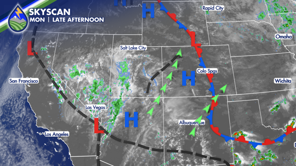
Tonight into early Tuesday, a little warm air moving in above cooler air near the ground will help create enough lift for isolated showers and a couple of thunderstorms across the plains. The better chance looks to hold off until late evening and overnight, generally after about 9:30 PM. These storms are expected to be weaker than what we saw over the weekend, and severe weather is not expected. Still, if you have evening plans or are traveling late, do not be surprised by a passing shower or rumble of thunder.
Tuesday
Low clouds may also develop overnight into Tuesday morning, especially along the southern slopes of the Palmer Divide. That includes eastern El Paso County, parts of Colorado Springs, and areas north of the Arkansas River. Southeast winds will push low-level moisture up against the terrain, which can lead to a gray start in a few spots. Tuesday morning temperatures should mostly be in the 50s across the plains, with a few Arkansas River locations closer to 60 degrees. Mountain valleys and higher terrain should not be quite as chilly as they were during the past couple of nights. A few locations around Teller County and the slopes of Pikes Peak picked up some frost over the weekend, but warmer air arriving from the southwest should limit that concern early Tuesday.
A hair warmer tomorrow. Most plains communities should reach around 80 degrees, with some low to mid 80s possible along the Arkansas River. It will remain comfortable for late September, though clouds and nearby storms may keep temperatures a little more variable from one community to the next. Tuesday’s best storm coverage should be over the mountains, particularly near the Continental Divide. Moisture continues to stream in from the southwest, and the higher terrain will have the best chance to take advantage of the afternoon heating. A few storms may drift east onto the plains late in the afternoon and evening, but storm coverage east of the mountains looks more miss than hit. Not everyone will see rain.
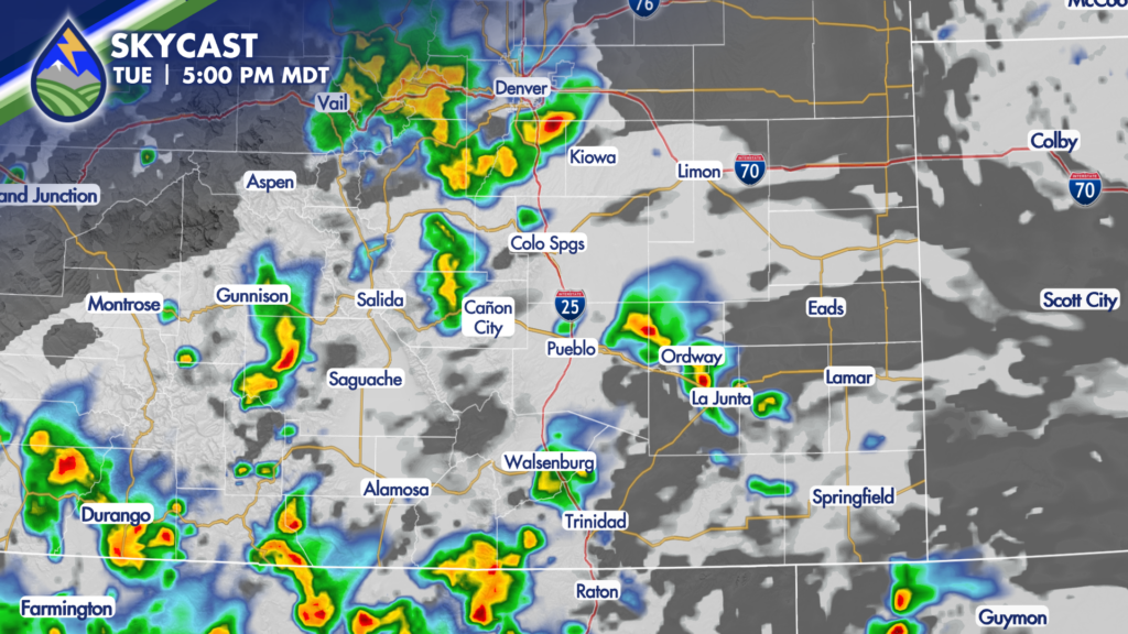
The more focused chance for heavier rain Tuesday appears to be near the Continental Divide during the day, then shifts toward southern areas during the evening as deeper moisture works north from Mexico and New Mexico. Some showers and thunderstorms may linger into Tuesday evening before gradually easing overnight. If you are headed into the high country, keep an eye on the sky and allow extra time for wet roads, lightning delays, and changing conditions near the passes.
Wednesday & Thursday – Timing the Wave
Wednesday is shaping up to be cooler, with no 80s currently expected in the forecast. Mountain communities may stay in the 60s, while the plains cool back as clouds and moisture increase. The setup is tied to moisture moving north ahead of a tropical system off the coast of Mexico, along with a weak disturbance moving from near Baja through Arizona and New Mexico. That disturbance is the key to the Wednesday and Thursday forecast. Its timing will determine where the best storm coverage develops and whether Wednesday or Thursday ends up being the more active day.
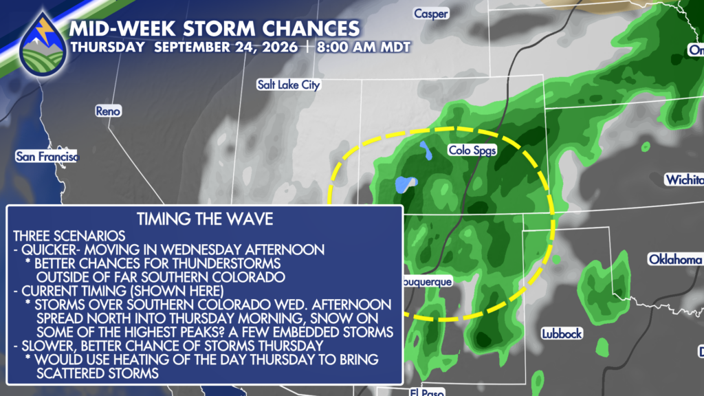
Right now, the most likely scenario brings the main part of the wave across Southern Colorado Wednesday night into Thursday. That would favor the best storm coverage across the southern tier on Wednesday, followed by scattered showers and storms continuing into Thursday. There is still some wiggle room in that timing. If the disturbance arrives a little faster, thunderstorms could become more widespread later Wednesday while daytime heating is still helping storms develop. If it is a little slower, Thursday could have the better opportunity for storms.
That kind of difference may only be a matter of several hours, but it matters when trying to pin down the most active period three days ahead. As the wave crosses the region Wednesday night into Thursday, temperatures may be cool enough for some light snow in the higher mountain areas. This is not looking like a major snow event, but the highest peaks could see a little accumulation while lower elevations deal with rain showers and an occasional embedded thunderstorm. Anyone with plans above timberline or over the highest passes should be ready for cold, wet conditions and rapidly changing visibility.
Our Weather. Together.






