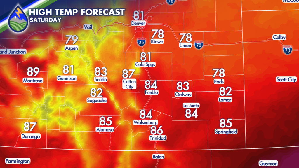
A weak cold front is moving through Friday night that will help to keep temperatures on Saturday a few degrees cooler.
While a touch cooler, these temperatures are still at or slightly above average high temperatures for this time of year.
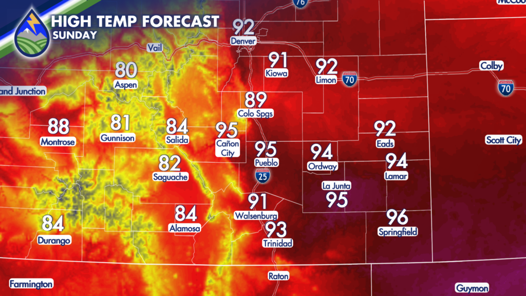
The brief cool-down won’t last long. Sunday is expected to bring above average temperatures back to the region, with highs warming into the 80s and 90s.
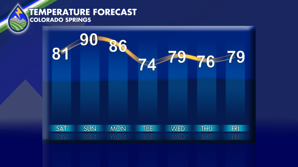
While Monday won’t be as warm as Sunday, the above-average trend will continue for one more day before a more potent cold front moves through by Tuesday. This is thanks to an upper-level system passing over the northern Rockies.
Tuesday will only get into the 60s and 70s for most, making it feel a bit more like September.
With the onset of this cooler air, storm chances are expected to increase in a big way! Increasing moisture in conjunction with the passing from front and upsloping winds behind the front will set the stage for heavy rain-producing storms beginning Monday. Tuesday and Wednesday look to remain active, with another day of storms on Thursday before we get a slight decrease in coverage and intensity on Friday.
Another system looks to move in next weekend that could bring renewed rain chances and another drop in temperatures!
As that system evolves, we will continually be tweaking our forecast – so check back often for updates!