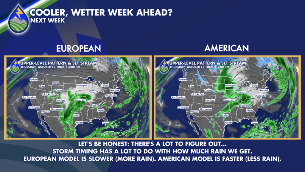
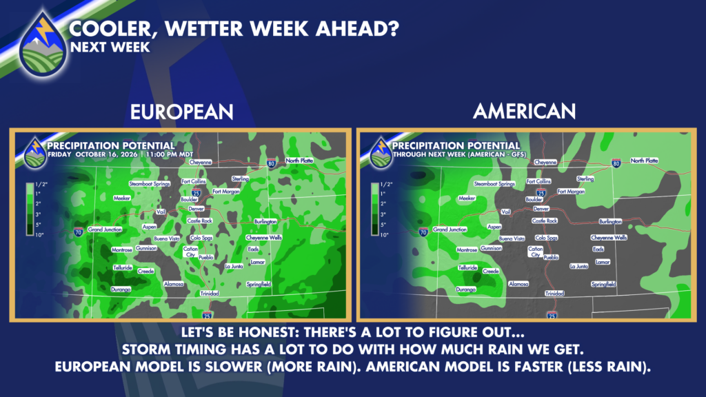
Regarding next week’s unsettled weather, there are elements that we are confident in and there are other’s that we’re still working on…
We know we have a really strong low over the west coast that’s going to move into the Great Basin by Tuesday. Ahead of this system’s arrival, moisture increases in the mountains this weekend. So, areas west of I-25 can expect increasing rain chances through Monday. We get cooler air filtering in on Tuesday, and a chilly day setting up for us on Wednesday. The proximity of the system on Wednesday will bring a chance for rain to finally make it out of the mountains and out across the plains… but this is where, in all honesty, the details get fuzzy…
One of our tools for extended-term forecasting is the European Forecast Model – this model’s suggesting that our low is going to hang out just to our west for the majority of this upcoming week! This would mean healthy rain chances could last into next weekend before this system moves overhead and exits to our east. This is a slower and wetter solution.
On the flip side, our American Model zips this system through here pretty quickly. In fact, this model ejects our low to the east by late Thursday. Obviously, the faster movement means fewer opportunities for rain… so this is the faster and drier solution.
Of course, trying to determine the track and timing of a system that hasn’t even moved fully onshore is challenging and considering we’re still about 5–6 days out, it’s not surprising that there are discrepancies. I’m hopeful that as this system develops and moves onshore, we’ll get more data that’ll help for us to really narrow down the timing of this storm.
In the meantime, check back frequently for forecast updates as more and more information becomes available.