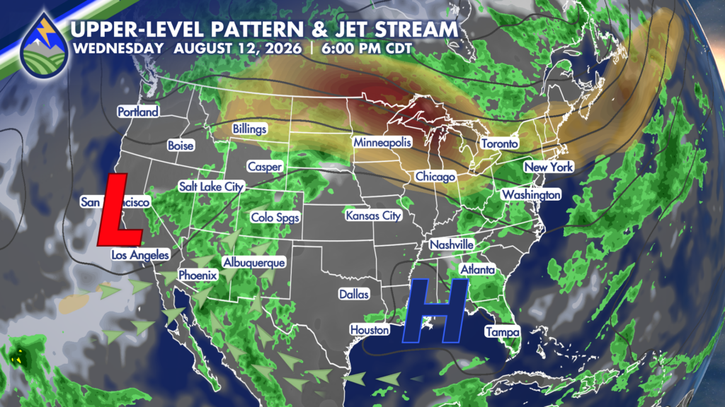
A combination of high pressure to our southeast and a trough of low pressure to our west will join forces to bring both Gulf and Pacific moisture into the state, beginning Wednesday.
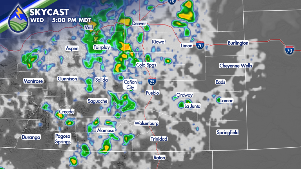
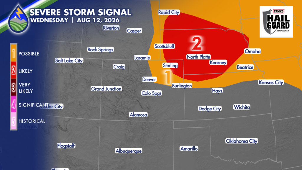
This uptick in moisture will help to generate a stormier afternoon, with the potential for heavy rain-producing storms developing over the high country first. Shortly after lunchtime, storms will begin moving eastward. There is the potential for scattered storms to impact the plains, with the best chance looking to be for the northeastern plains where there is the potential for a few strong to severe cells. The primary threat with the strongest cells Wednesday will be the potential for strong, gusty winds and heavy rain. Should a heavy rain-producing storm move across active fires or recent burn scars, flash flooding will be a concern.
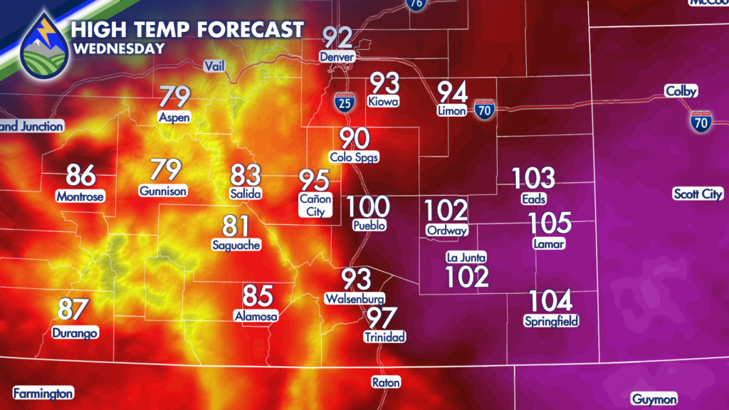
Before storms move through, it will be another day of above average heat. Lower elevations will be warming into the 90s and 100s, with 70s and 80s in the mountains.
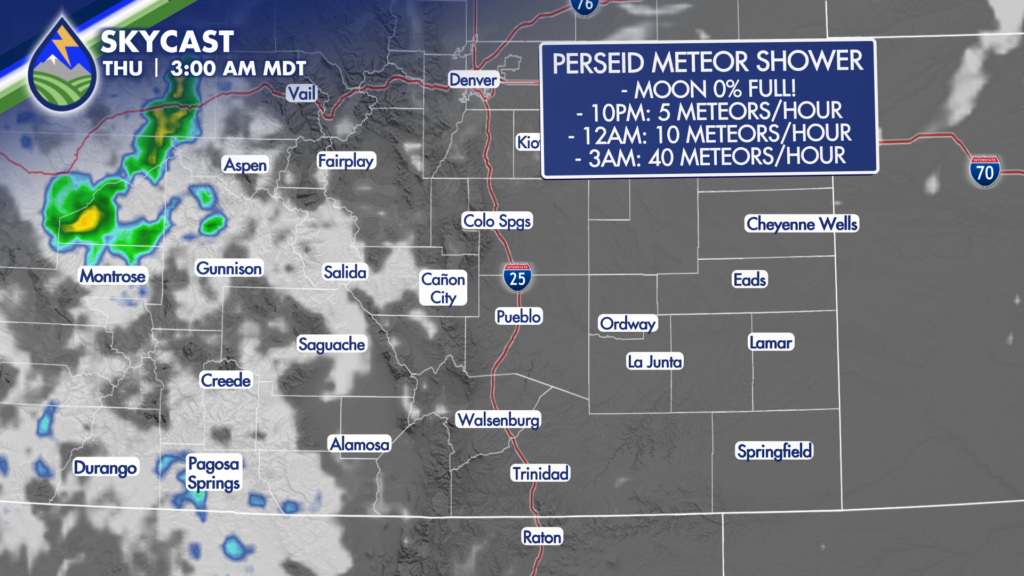
There is a really unique opportunity to see the Perseid Meteor Showers Wednesday night and Thursday morning! The shower will coincide with a new moon, which means the moon will be zero percent full. That translates to a darker sky, and easier viewing! There should be at least some breaks in the clouds, especially after midnight when the shower is supposed to peak!
For the best opportunity to see the shower, you’ll want to go somewhere with limited light pollution and give yourself 30 minutes for your eyes to adjust to the dark. Look toward the east or southeast. There is the potential for 5 meteors per hour around 10PM, 10 meteors per hour around midnight and 40 meteors per hour around 3AM. These meteors are entering the atmosphere at about 37 miles per second!
Of course, the later storms last into the night, the longer clouds will impact the views. So, be sure to keep an eye on the continuous forecast updates on Peaks2Plains, it’s our weather together.