


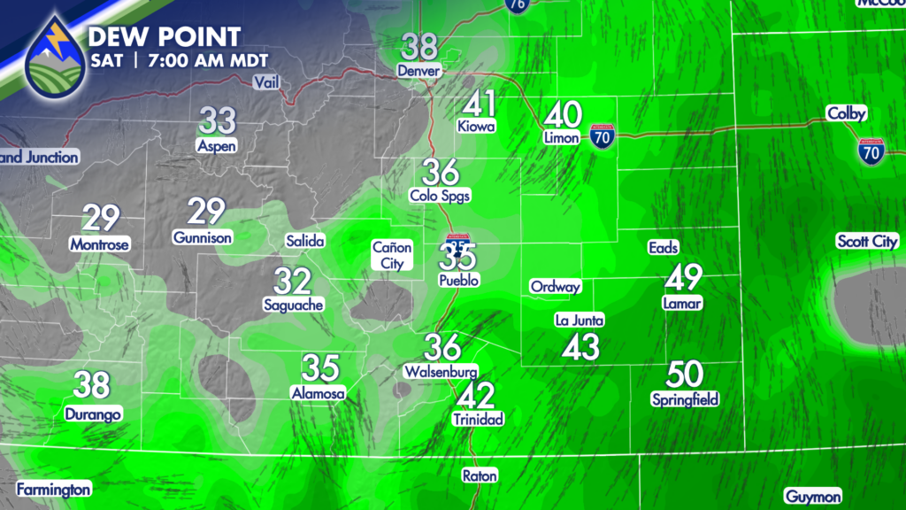
SATURDAY STORMS: Dewpoint temps aren’t too bad for the time of year as the day begins. Thank the cold front that had our temps cool east of the mountains yesterday. Energy from the southwest moves overhead later today and we will get thunderstorms to develop. First over the mountains and then out across the plains.
I’ve got the paintballs on here for 5pm. What the heck are paintballs? I took the moderate to high intensity radar depiction from three different computer models and instead of showing you the normal green -> yellow -> orange -> red color depiction of radar, I used one color per model for anything with a radar intensity of 40dbz or higher. Light showers aren’t depicted here…just thunderstorm cores.
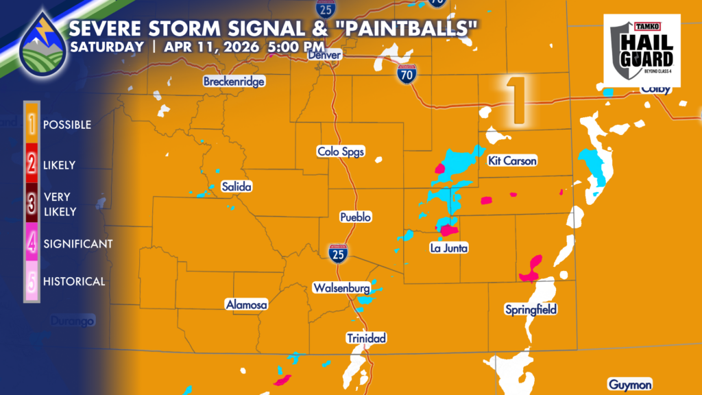
We look for where the multiple models show storms at the same time in the same place. This is a good analytical tool to find locations where there is more likely to be strong storms, and areas where the confidence is less. Overall the best chance of a severe storm is on the edge of the deeper moisture at the surface over the plains this afternoon.
Wind is the biggest threat today with some gusts near 60mph possible with the strongest storms. Stronger storms today will also have some bursts of rain.


