


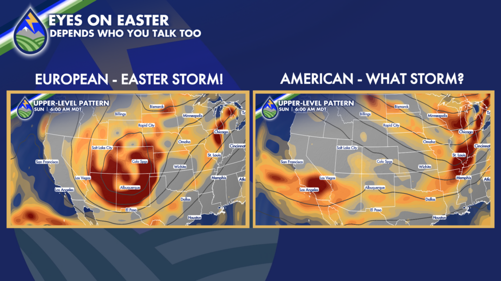
While there is some uncertainty (models will always have this a week or more out) as you can see the European and American models for Easter as reading different books it seems…For a multitude of reasons, those of you with Easter sunrise service plans should be ready for your back-up plan this year.
I’ve been talking about this for weeks here. This early April pattern change, and the chance for a stronger late-season storm to me looks more likely than whatever the American Model (GFS) is doing. The evolution of the troughs out in the ocean, jet, cold air, surface pressure, moisture movement, etc has been more consistent and frankly makes more sense in the European output and I think we should plan on a moderate strength to perhaps even stronger storm in the neighborhood next weekend.
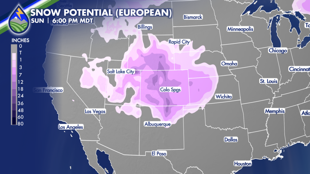
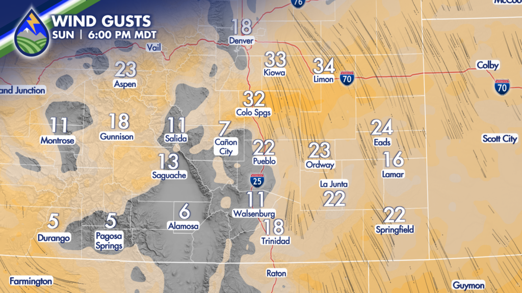
There are details to go certainly, but there’s decent potential for a storm with significant snow and wind over Colorado. This will be a much needed boost to sky slopes looking to give boarders and riders a few good days, and maybe extended the season for some. On the backside of the storm during the day on Easter given the current timing, you should expect wind to come with the snow east of the Rockies.
There’s more than enough to watch to have your ears perked, your eyebrows raised, and your weather senses activated. Lots of work to do on this one, and you bet I’m on it.
Get my updates, storm alerts, and ability to track storms yourself when you’re on the go in the Peaks2Plains Weather App. Download it today!
Our Weather. Together.


