


SIGHTS ON SATURDAY
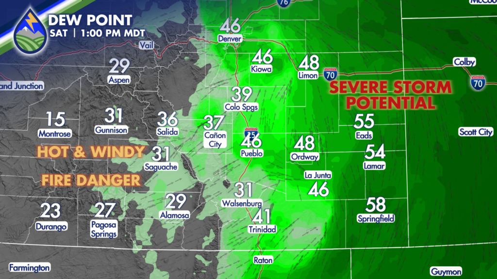
Your weekend begins with a very interesting weather day. As a system approaches the region from the west, scheduled to move across Wyoming Saturday evening, we will get a developing pre-frontal/lee trough/dryline over eastern Colorado.
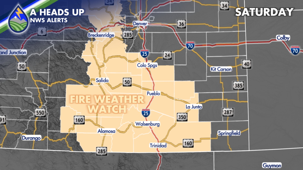
West of the moisture gradient we turn hot, windy with high fire danger. The Fire Weather Watch will most certainly be upgraded to a Red Flag Warning.
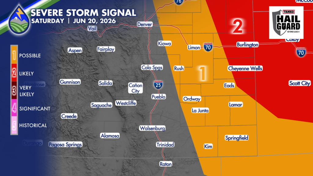
East of the dryline we’ll be in line for storms to develop and they’ll likely be strong with hail near 1.5″ in diameter possible, and late in the day near Kansas, perhaps an isolated tornado.
There is detail to figure out about where the western edge of the moisture will be. Be prepared and get the Peaks2Plains Weather forecast for where you are directly from Matt and Merry in the app. Download it today!
APPLE: https://apps.apple.com/us/app/peaks2plains-weather/id6756083668
ANDROID: https://play.google.com/store/apps/details?id=com.peaks2plains.android.weather
Sponsored by @tamkobuildingproducts – We track the storms — but what’s protecting your roof when they hit? TAMKO’s HailGuard™ shingles are engineered for higher impact performance and the first and only asphalt shingle system backed by a hail warranty, designed for hail-prone markets like ours. Visit TAMKO.com/locate-a-contractor to connect with a local installer. See TAMKO’s HailGuard™ Extended Limited System Warranty for complete terms and details.


