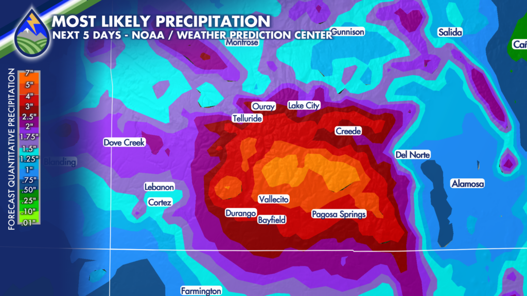







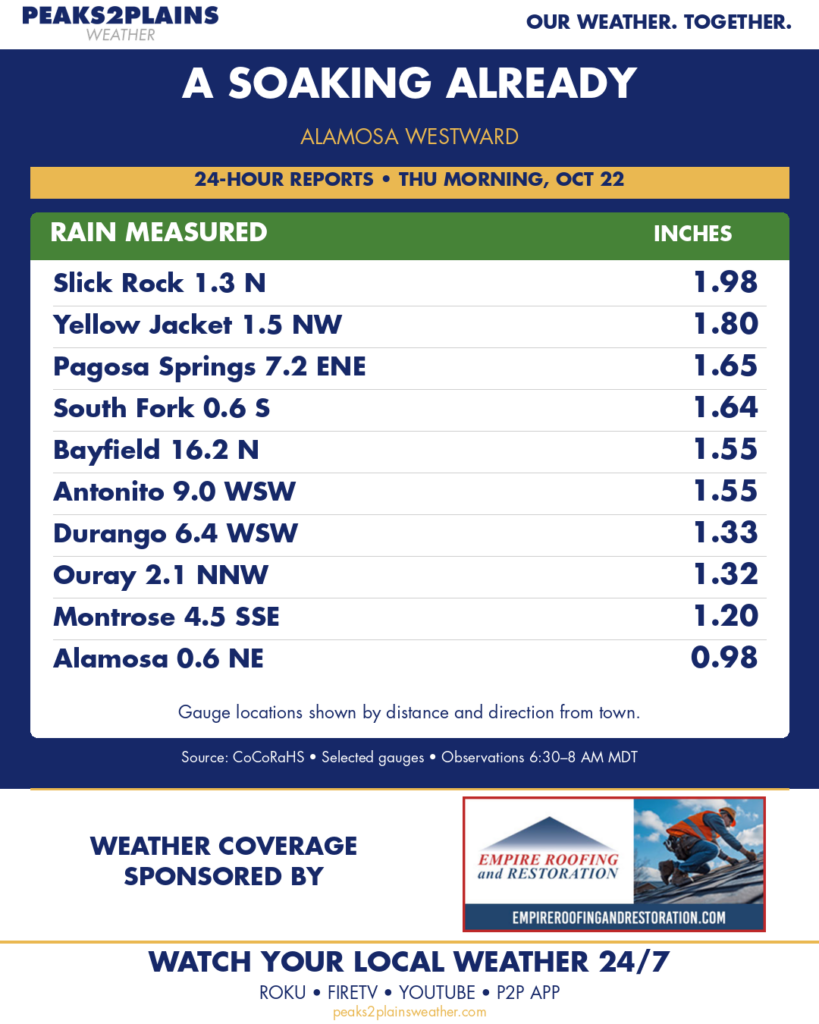
Rain has already been heavy in southern Colorado from Alamosa westward. I expect another 1-4″ in the next 24 hours in the same areas, especially on the south and southwest facing slopes of the San Juan Mountains.
Be alert in this area….Today is the highest-impact day of the ongoing southwest Colorado rain event. A Flood Watch remains in effect around Durango, Pagosa Springs, Silverton, Wolf Creek Pass and the Upper Rio Grande region, ending Friday as drier air moves in for a day.
Storm totals around parts of the San Juans may reach 3.5 to 4.5 inches, with isolated totals approaching 5 inches where showers repeatedly cross the same terrain.
The ground is already wet, and snow levels near 12,000 to 13,000 feet mean rain will fall on some existing high-elevation snow. That combination could quickly increase runoff into the San Juan, Piedra, Animas and La Plata rivers, along with smaller creeks and tributaries. Flash flooding, rockslides and mudslides are the main concerns near steep terrain, burn scars, canyons and mountain roads.
A stronger thunderstorm could also produce a localized wind gust above 60 mph, although widespread cloud cover makes that part of the forecast less certain.