


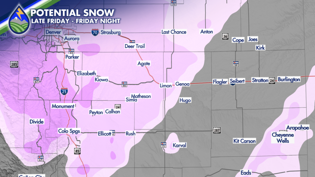
Friday afternoon into Friday night snow is looking more likely for #Denver, #ColoradoSprings, the foothills and the Palmer Divide.
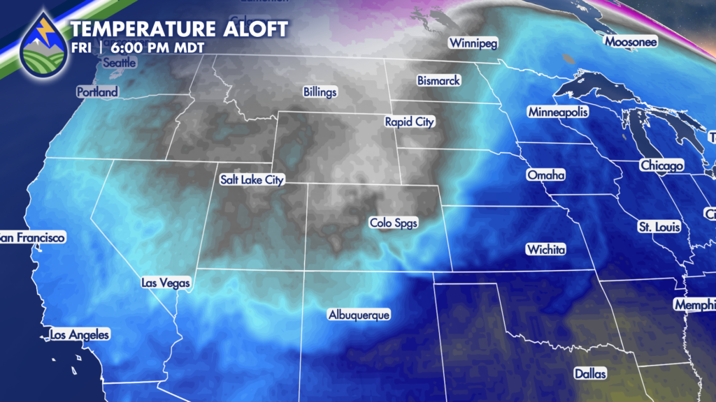
The second storm of the week is colder than the first one. Temperatures in the mid-levels of that atmosphere at about 10,000′ drop very quick on Friday. From about 36° as the day begins to 12° by dinner. That drop and those numbers would get snowflakes going, even in the heart of Colorado Springs, Friday afternoon.
I’m showing you this for two reasons: 1) the trends over the last 48 hours have been looking more and more favorable. 2) It’s been awhile and it will be a shock to the system.
Experience matters. Detail matters. The communication about the probabilities and different weather experienced over small distances because of terrain is what @peaks2plainsweather is all about.


