







COOLDOWN
STORMS FOR A DAY
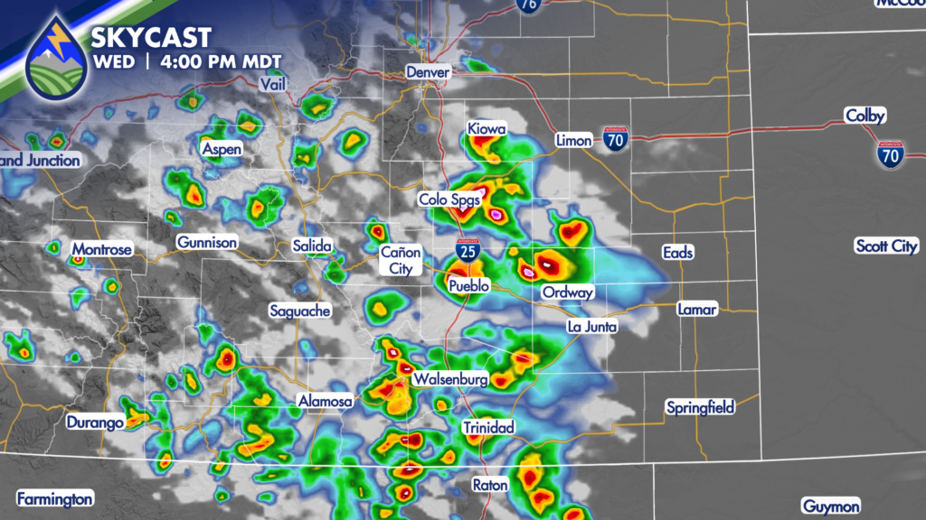
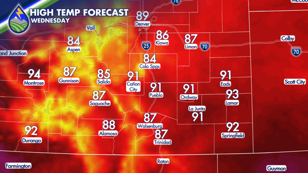
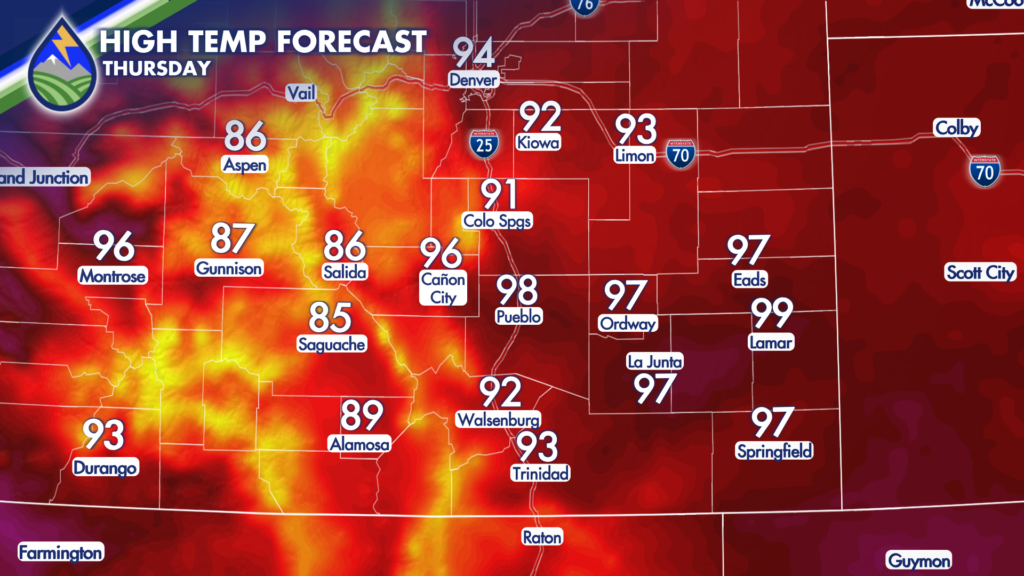
The northwest flow aloft will push storms to the southeast during the afternoon and evening on Wednesday. Storms have more fuel east of the mountains with dewpoint temps in the 50s and 60s behind the overnight cold front, so they will be stronger over the eastern slopes and plains than any mountain storms farther west.
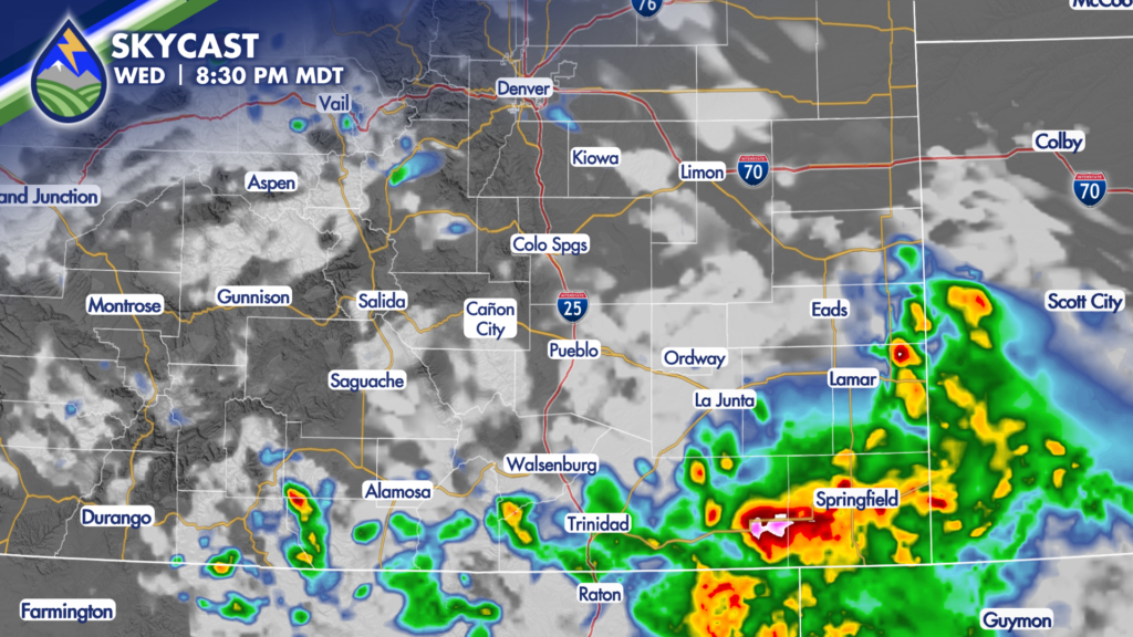
Storms will shift over the eastern plains through the late afternoon and evening, exiting Colorado by about 9pm for most.
HAIL, DAMAGING WIND POSSIBLE
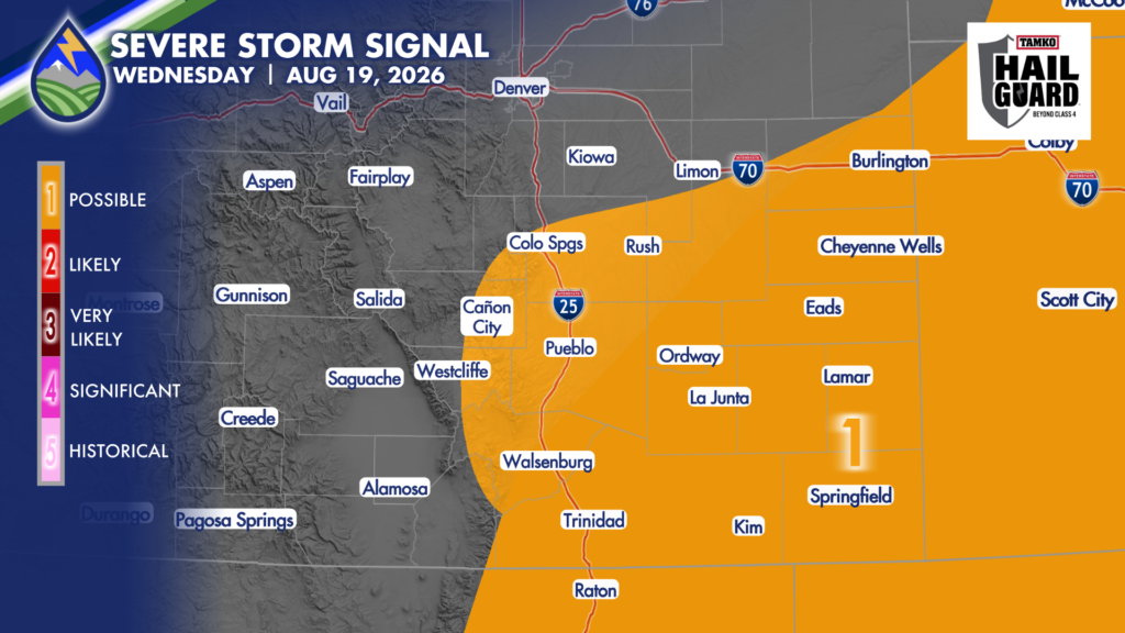
Some of the storms may get strong as they form in, or move into the post-frontal low-level juice. As storms come off the Palmer Divide or the foothills in the early afternoon they may bring some hail around an inch in size. In theory the strongest storm or two could put down some ping pong ball-sized hail for a brief window before getting too far east.
Damaging wind gusts become the main severe threat as storms move east and start to cluster later in the day and early in the evening. These cold pools can descend rapidly and fan out ahead of and behind the storm. Like what we saw over the weekend, this wind can cause some damage. Over the weekend, about two-miles of power poles were snapped along highway 287 south of Springfield in Baca County. We’re hoping something similar doesn’t happen Wednesday.
HEAVY RAIN
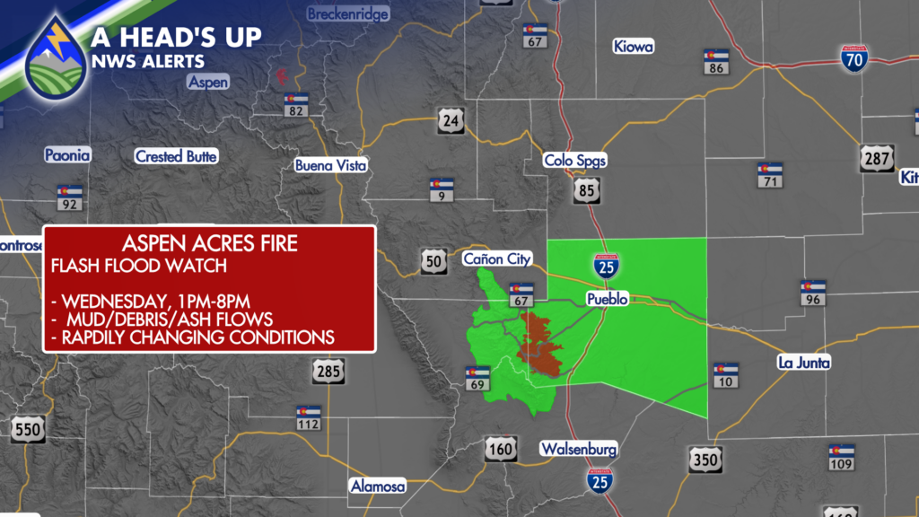
Typically when we talk severe storms we’re also talking heavy rain. After a couple of quieter days many of us have seen the risk of flash floods come back down to normal levels…but the Aspen Acres Fire remains at an elevated risk of mud, ash, and debris-flows. Storms will mvoe southeast today and might bring a couple different rounds of storms across the fire Wednesday. We will watch it close. A Flash Flood Watch is up through the afternoon and early evening.






