


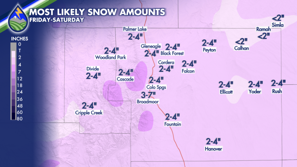
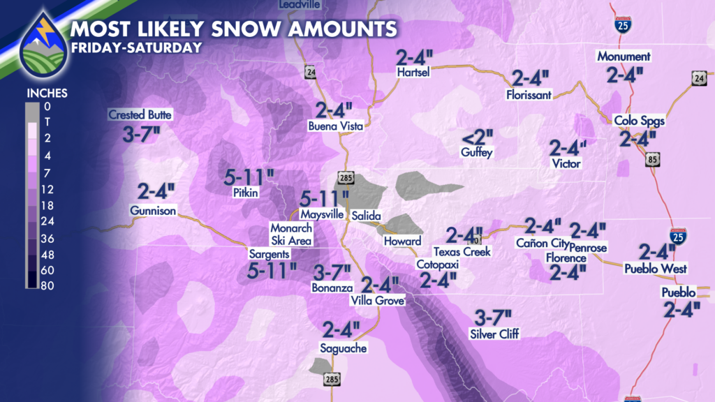
There may be more areas on the slopes of Pikes Peak in the 3-7″ range than what is being represented here.
The 3-7″ area may extended farther north along the Rampart Range than what I’m depicting here. There are always unknowns with every forecast and that is one of them. It’ll be an airy, fluffy snow!
The 3-7″ area may extended farther south along the slopes of Pikes Peak than what I’m depicting here. There are always unknowns with every forecast and that is one of them. It’ll be an airy, fluffy snow!
This snow will be easily wiped off the car windshield, broomed off the sidewalk, or blown with a leaf blower!
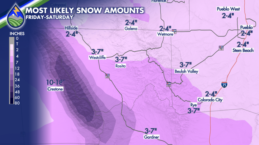
There will be some areas of heavier snow in this area, particularly over the Sangre de Cristo Range.
Some areas are likely to get more than others between the valleys and the mountains in this area.
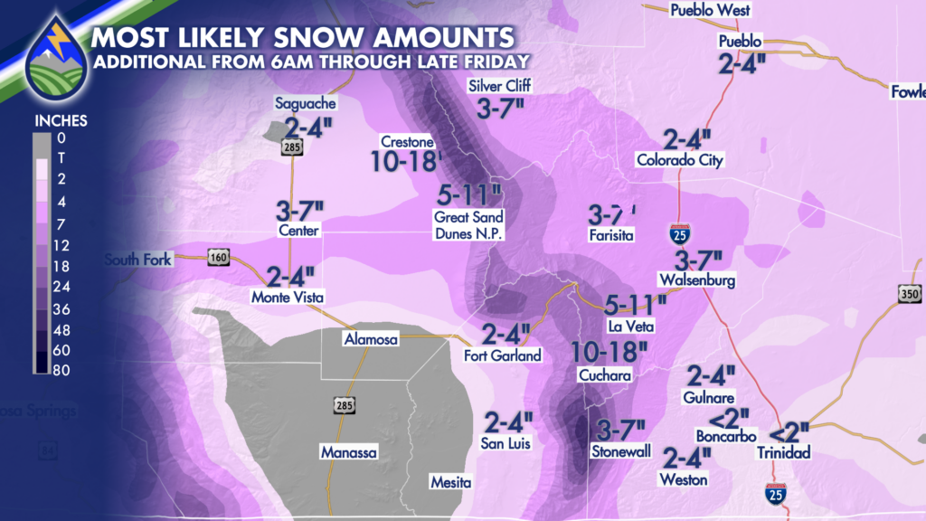
Snow will be heaviest over the Sangre de Cristo Mountains. Alamosa will be right on the border between heavier snow over the northern half of the valley and lighter amounts southward.
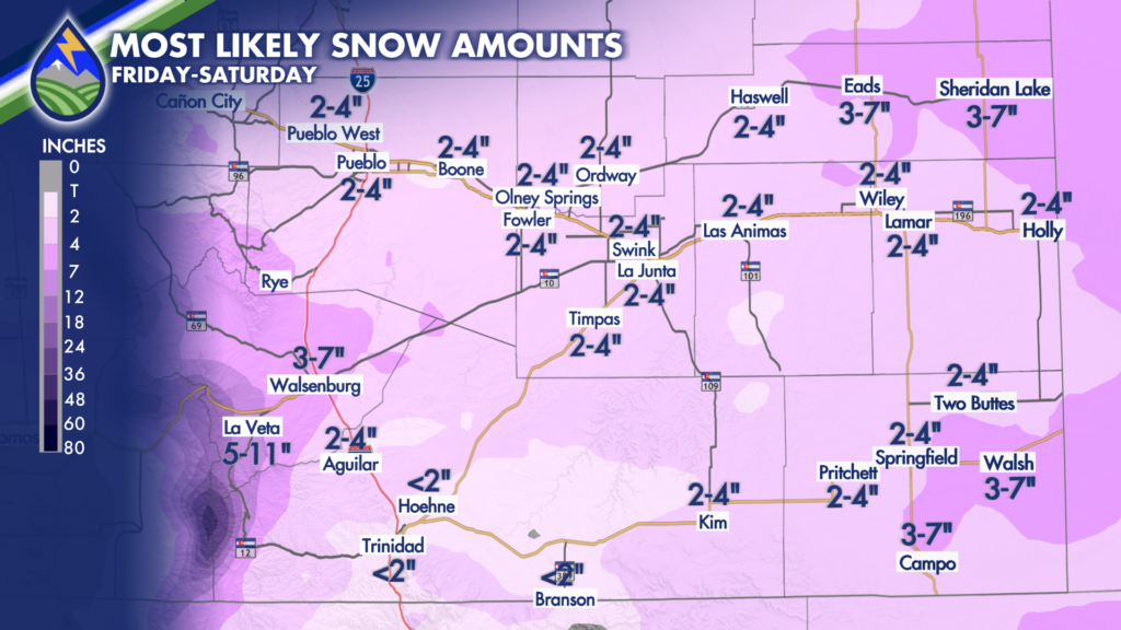
Amounts in this area likely range between 1 and 4″ except near the near the state line where some pockets of 3-7″ could occur.
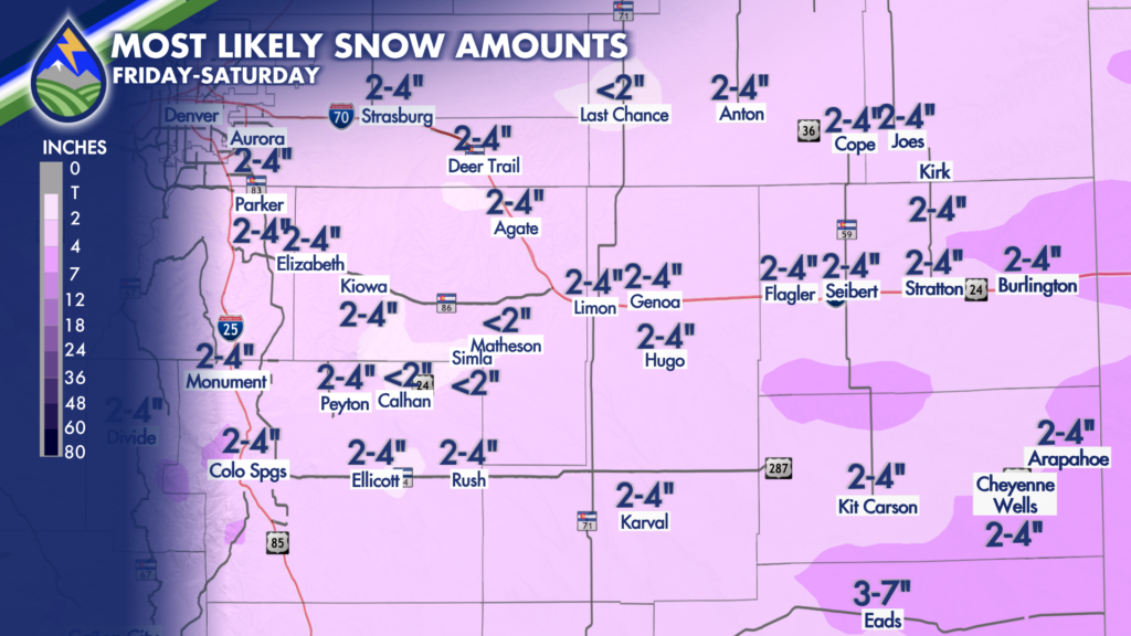
A general 1-4″ of airy, fluffy snow should cover this area. Higher amounts may exist closer to Kansas, especially south of Interstate 70.


