


STRONG NIGHTTIME STORMS
An atypical pattern for Colorado is likely tonight with very large hail possible in the cities.
Isolated storms east of the Rockies during the day may produce 1″-1.5″ diameter hail.
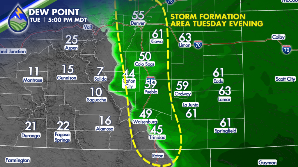
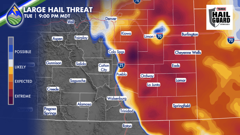
Of greater concern is tonight. A significant westward push of very moist low-level air with dewpoint temperatures near 60° will hit the eastern slopes of the Rockies this evening. It will interact with a wave moving through aloft and abundant wind shear to produce supercell thunderstorms capable of very large hail between 2″-3″ in diameter.

Some models are pinging the Pikes Peak Region in particular with storms this evening. Merry and I will have live updates on the Peaks2Plains Weather 24/7 channel at 5pm and 6pm with detailed updates on what to expect through the evening and live coverage of the storms as they develop tonight.
We’ll tweak the forecast through the day in the Peaks2Plains Weather app. Download it while the weather is quiet ahead of the storms for the most detailed, useful, and accurate forecast from the area’s most experienced weather team.


