







SETTING THE STAGE
Are you ready for some changes? a cold front brings a noticeably different feel by Tuesday. Moisture is also increasing from the southwest, setting the stage for more opportunities for showers and thunderstorms as the week moves along.
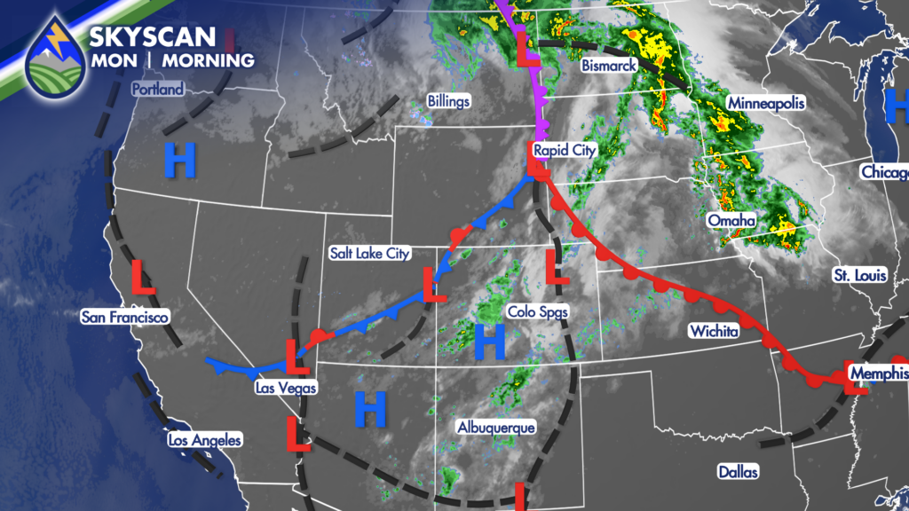
THE ARRIVAL OF THE FRONT
Monday remains the warm day across the region. Expect 80s around the Pikes Peak region and northeastern Colorado, while Pueblo and communities east along the Arkansas River toward the Kansas line reach the 90s. The mountains begin to cool a bit as moisture increases.
That temperature change will be one of the biggest stories of the week. Areas that reach the 90s Monday may be 10 to 20 degrees cooler Tuesday. Some spots will only make the 60s, and much of the lower elevations will feel far more comfortable than they did to start the week. It is the kind of cool-down that offers a little early taste of fall across Colorado.
Cooler Air Impacts Storm Chances
Tuesday will bring a mix of clouds and sun, with more moisture continuing to stream in from the southwest. The best chance for afternoon showers and thunderstorms will be over the mountains. Cooler air behind the front limits the instability storms need as they move away from the higher terrain, so storms may weaken while trying to reach the I-25 corridor and the eastern Plains. A few showers or storms could still make it across the cities, but the Plains look quieter overall than the mountains.
Even so, any storm this week can produce lightning, brief gusty outflow winds and a quick burst of moderate to heavy rain. Slow down if heavy rain reduces visibility while driving, and head indoors when thunder is heard. In the mountains, foothills and near recently burned areas, stay alert for rapidly changing weather and avoid low spots or drainages when rain is falling nearby. Rainfall can vary greatly over short distances in this kind of pattern.
Better Storm Chances Mid-Week East of the Mountains
Wednesday and Thursday are the days we are watching most closely for thunderstorms and heavier rain across Southern Colorado. Temperatures recover into the 80s for many lower-elevation locations Wednesday, but the stronger moisture supply means storm chances improve not only over the peaks but across parts of the plains as well.
The middle and latter part of the workweek looks unsettled, with several opportunities for showers and thunderstorms as waves of energy move through the southwest flow. Wednesday into Friday carries the better chance for more meaningful rain, especially across the mountains, foothills and adjacent plains. Where storms repeatedly move over the same area, rainfall could add up quickly. Burn scars deserve extra attention during periods of heavier rain because runoff can develop faster there.






