







Next best rain – and snow – chances in Colorado hinge on an Alaskan storm and the remnants of what is now Hurricane Rachel. The upper-level system is expected to come in from the northwest, and it should bring cooler air into Colorado. Right now, the most likely window for that change is Monday through Wednesday early next week.
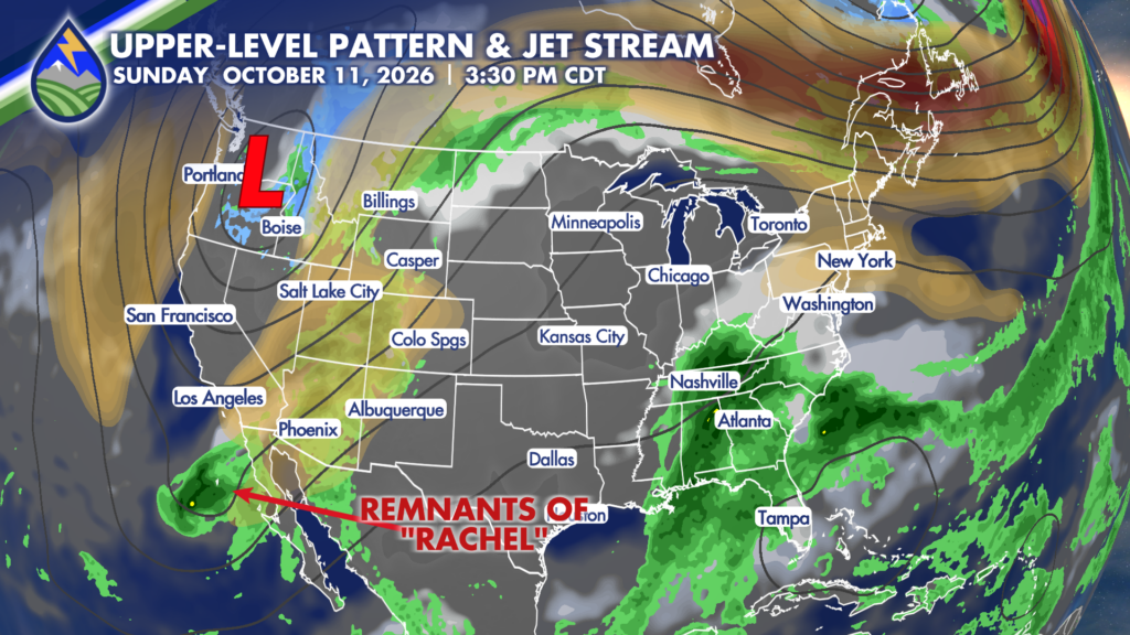
A big component of the forecast is if moisture associated with the remnants of Hurricane Rachel gets pulled into the larger weather system. One computer model has been consistent in bringing that tropical moisture toward Colorado, while another keeps those remnants farther west over the Pacific. That difference matters. If the tropical moisture gets involved, rain and snow chances could increase, especially for the mountains and high country. If it stays west, the cooler air still arrives, but the system would have less moisture.
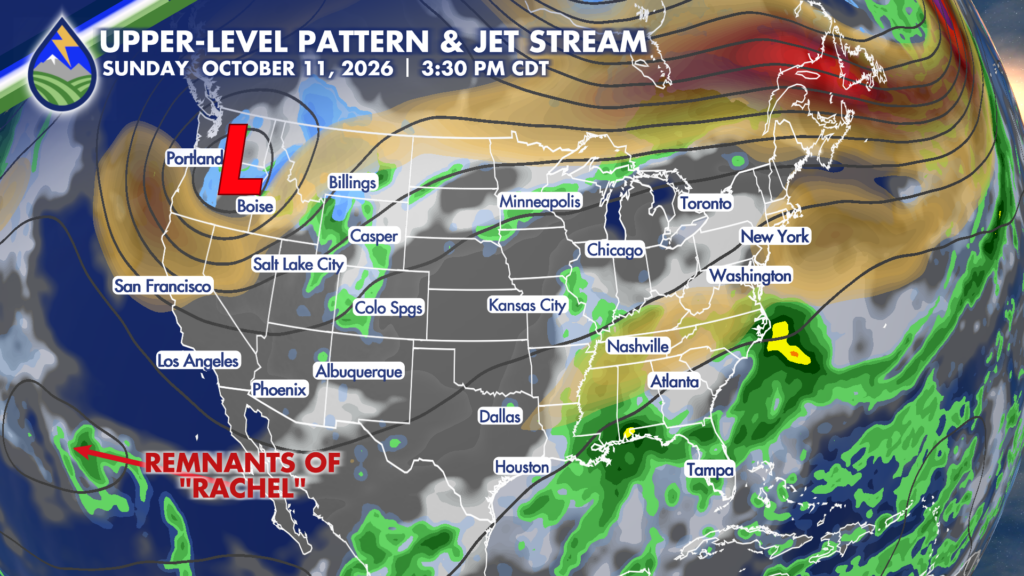
Even if Rachel’s remnants do get caught up in the flow, the large low to the north might make it a more favorable moisture-maker for the mountains compared to the Front Range and plains, but it’s a long ways out there.
We’ll keep watching it – it’s a fun one to see evolve!






