







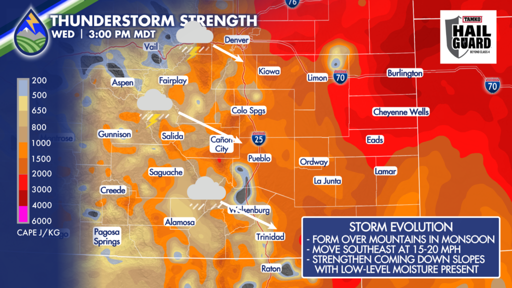
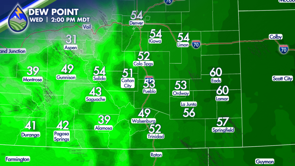
Storms will begin developing over the mountains during the afternoon in the monsoon. As they move off the higher terrain and into the eastern slopes, I-25 corridor, and nearby plains in the afternoon, they will encounter richer low-level moisture behind the front. Dew points in the 50s and 60s across the lower elevations will give storms more fuel to work with.
That means some storms may organize quickly as they come off the mountains. The initial concern with the stronger cells is large hail, potentially up to around 2 inches in diameter in a few spots. Keep a close eye on the sky, and keep the Peaks2Plains Weather app handy – keep your location turned on!
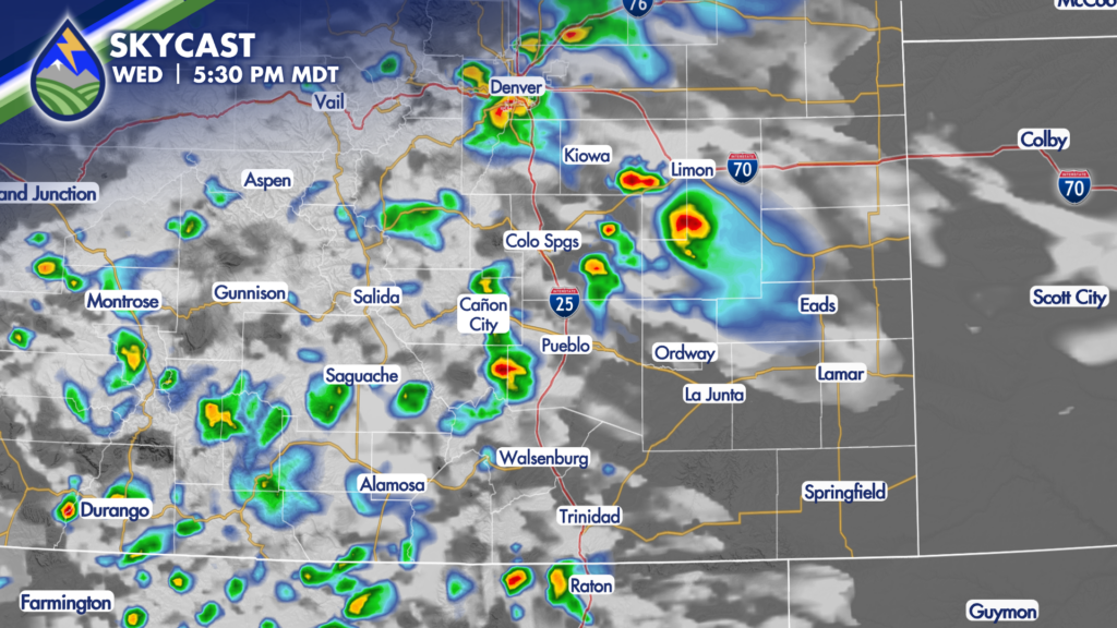
The atmosphere also has enough wind shear to help some storms organize and rotate a bit. Winds near the ground will be southeasterly behind the front, while winds higher up are out of the northwest. That difference in wind direction with height can help separate a storm’s updraft from its downdraft, allowing a stronger storm to hold together longer and increasing the hail potential as storms cross the interstate and move into the adjacent plains.
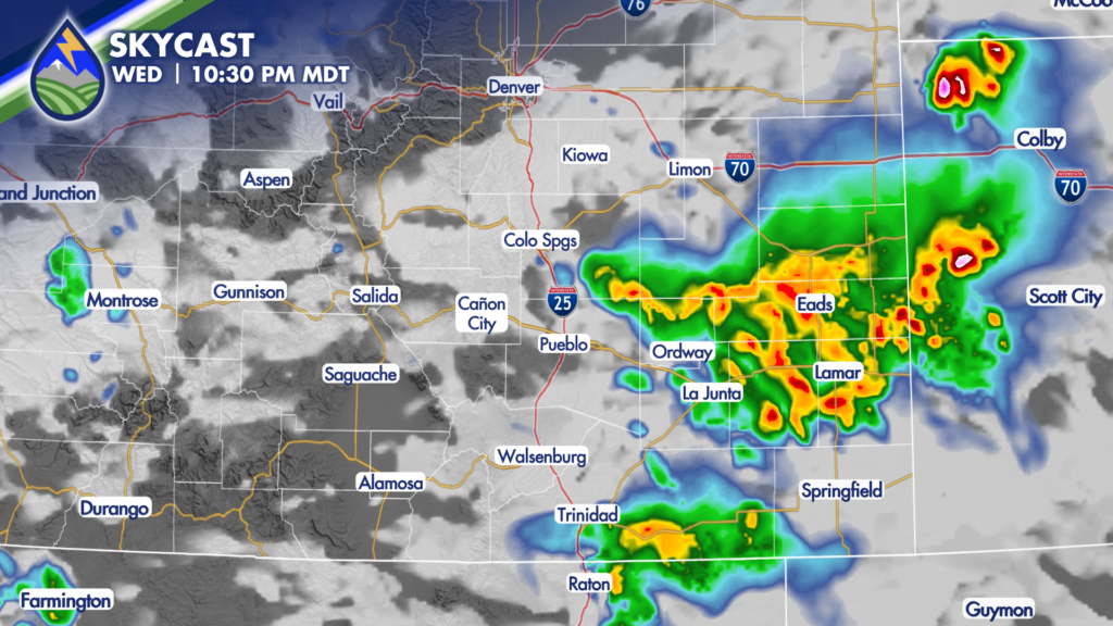
Later in the evening, the large-hail threat may ease back some as storms mature and their cold pools begin interacting. At that point, gusty outflow winds become more of the concern. Storms can still produce heavy rain, frequent lightning, and quick changes in conditions even if they are no longer producing their largest hail.






