


SEVERE STORM THREAT TODAY
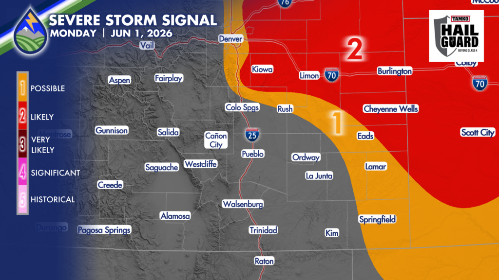
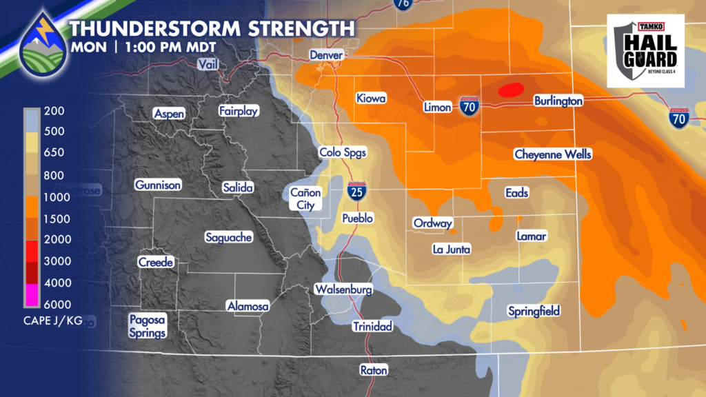
PALMER DIVIDE: A strong storm likely develops on the western edge of the severe storm signal area I’ve drawn over southern Douglas or northern El Paso County. This storm will likely move ENE into Elbert County and become capable of hail around 1-1.25″ in diameter.
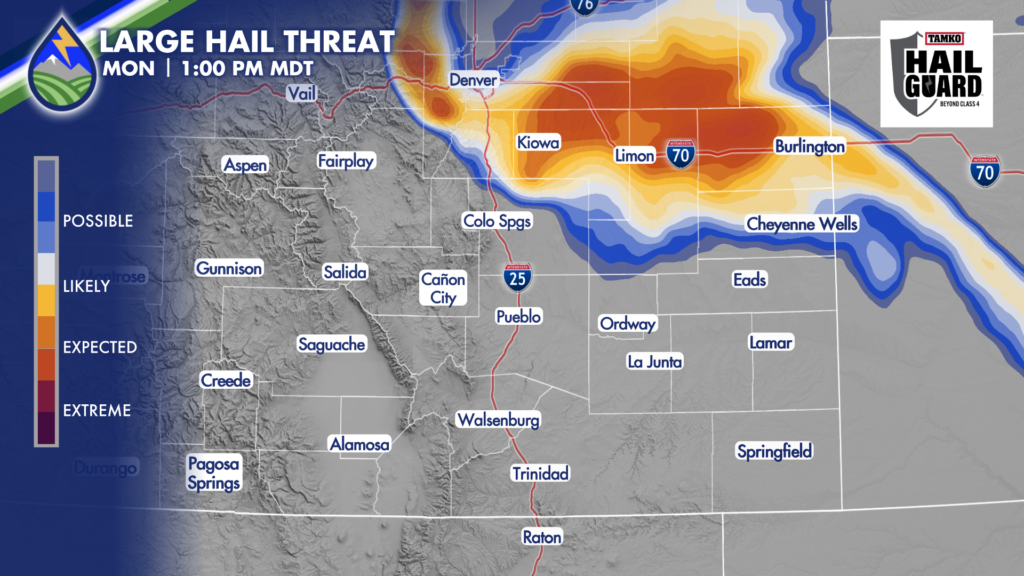
If moisture is deep enough and the storm gets an ESE movement to it, it may ride the El Paso and Elbert County line and could become capable of hail near 2″ in diameter. In this event, the storm would likely continue rolling east along the southern slopes of the Palmer Divide south of I-70 and could become capable of producing a tornado in eastern Lincoln County into Kit Carson or Cheyenne County in the late afternoon.
SOUTHEAST CORNER: We’ll also keep a close eye on Baca, Bent and Prowers Counties where storms will likely develop between 2-3pm along a dryline. These storms may produce hail near 1″ in diameter and wind gusts near 60mph as they move toward Kansas.
FARTHER WEST: There may be a few high-based, gusty-type storms over the mountains this afternoon. These will be the type that produce more wind than rain as there will be very dry air below the bases of the clouds and rain will have a tendency to evaporate before reaching the ground.


