







Southern Colorado has an interesting weekend ahead, with thunderstorms possible both days and the stronger storms likely over the eastern plains Saturday. The setup brings a backdoor cold front into eastern Colorado, increasing low-level moisture while stronger southwest winds higher in the atmosphere provide the wind shear storms need to organize.
We’ll watch the Pikes Peak region, Palmer Divide, and the plains east of I-25 as we head through the afternoon. Storms should begin developing along the eastern slopes and terrain features, then move east and northeast onto the plains. The most likely window for storms to get going is roughly 1:30 to 3:00 p.m., especially around the Palmer Divide. That includes areas east and northeast of Colorado Springs, eastern El Paso County, Douglas County, Elbert County, and toward Lincoln County. One or two storms in that corridor could become supercells, bringing the potential for large hail and strong wind gusts.
For communities east of Colorado Springs and east of Castle Rock, storms may strengthen as they move farther away from the Interstate 25 corridor. Hail in the stronger storms could range from around 1 inch to as large as 2 inches in diameter. Storms will be capable of frequent lightning, brief heavy rain, and sudden gusty winds as well, so have a way to get weather alerts if you have outdoor plans.
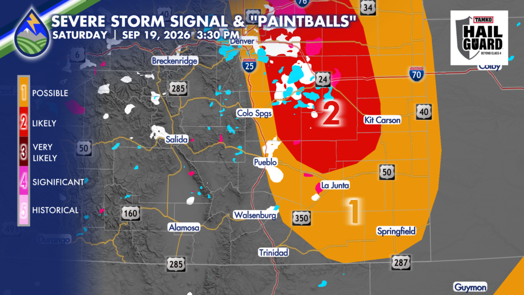
Farther south, including Pueblo County and the eastern plains along and south of the Arkansas River, the details are a little less certain. If storms form during the earlier afternoon, roughly between 1:00 and 4:30 p.m., they could produce hail around an inch in diameter. That is the scenario where storms develop more directly over the southern plains rather than waiting for activity farther north to send the rain-cooled outflow over the plains. If this is what kicks storms off, we’ll see them late afternoon and evening and have more of a straight-line wind threat.
Over the mountains drier air has moved in and storm coverage looks lower than it has been much of this week.






