


One of the things we’re working on for the storm in the late Sunday through Tuesday time frame is the likelihood of the storm to be strong enough to have a circulation with it. And, if it does where is that circulation.
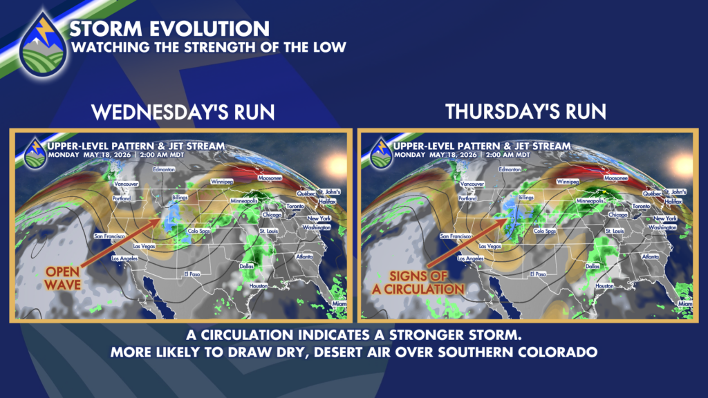
If the heart of the system is up to our north – which it is likely to be – here’s what the storm having a circulation means for our area. We will be more likely to see desert air pulling into the storm moving over our area. Precip chances will be less – especially the farther southeast you are – and the air we get won’t be as cold.
Here’s what you should take from this…the farther northwest you are, the more likely to get moisture – and perhaps significant. The farther southeast you are, the less likely to get moisture…and you better hope something changes in the evolution of the system!


