







Monday brings another round of afternoon and evening thunderstorms across Southern Colorado, following several days in which some neighborhoods have picked up more than an inch of rain while others have seen much less.
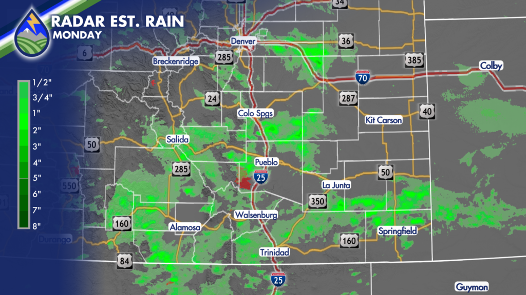
Storms will again develop first over the mountains, then work east across the I-25 corridor and onto the plains. They may get going a little later today than they did Sunday, but the timing still lines up with after-school and after-work plans. Keep an eye on the sky through the afternoon and into the evening if you have practices, errands, outdoor work, travel, or events planned.
For Colorado Springs, Monument, Woodland Park, Fountain, Security-Widefield, Falcon, and nearby communities, the main storm window will be later in the afternoon through the evening. Storms may linger into the late evening in spots, especially as outflow boundaries and leftover moisture keep things active. Not every location will get rain, but a storm that moves over your neighborhood can quickly bring a downpour.
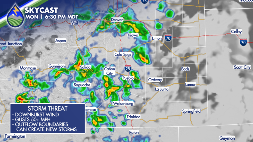
Heavy rain remains one of the primary concerns. The atmosphere has enough moisture to support locally intense rainfall, and slow-moving or repeated storms can put down a lot of water in a short time. Be especially mindful around low-lying roads, normally dry washes, small creeks, drainage areas, and places where water tends to collect. If water is covering the road, turn around rather than trying to drive through it.
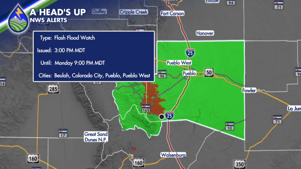
The Aspen Acres burn scar is under a Flash Flood Watch from 3 PM through 9 PM Monday. Rainfall runoff can respond quickly over burn scars, even when a storm is not directly overhead for very long. Folks near the scar, along drainages downstream, and anyone traveling through the area should stay weather-aware this afternoon and evening.
Gusty thunderstorm winds are another concern. A few storms could produce wind gusts over 50 mph, capable of blowing around unsecured patio items, trash cans, temporary signs, and other loose objects. Stronger storms can also create sudden wind shifts and reduced visibility from heavy rain or blowing dust, particularly on the plains. If you are heading out, it is a good idea to secure lightweight outdoor items before storms begin.
Temperatures will still run hot ahead of the rain. Colorado Springs should reach the middle 80s, with lower 80s around the north end of town. The eastern plains will be in the 90s, with a few locations flirting with 100 degrees. It will feel a little sticky at times as well, thanks to the added moisture. Mountain valleys generally stay in the low to middle 80s, with cooler readings at higher elevations.
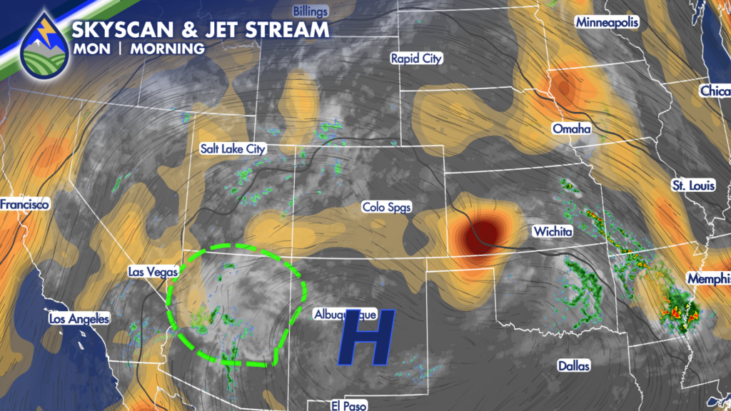
This pattern is being driven by high pressure centered over New Mexico, with moisture and little disturbances rotating around it into Colorado. That setup has been favorable for daily mountain thunderstorms that drift east, and it stays in place for the next several days. The details will vary from day to day, but the overall message is to plan around afternoon and evening storms.
Tuesday looks similar in many ways, although storms may fire a couple of hours earlier. Development should still favor the mountains and adjacent foothills first, with storms moving east toward the urban corridor and plains. Unlike Monday, a few storms may also be able to develop farther out over the plains. Starting earlier means storms may also wind down earlier Tuesday evening.
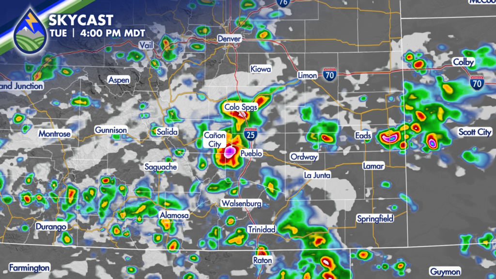
Tuesday could bring another round of heavy rain, gusty outflow winds, and a somewhat better chance for wet microbursts. A few storms may produce hail around an inch in diameter. The stronger-storm potential appears more focused over the plains, while mountain and foothill storms will continue to carry a locally heavy-rain concern. If you have outdoor plans Tuesday, build in extra time and have a nearby indoor option.
Wednesday still looks stormy, with another opportunity for showers and thunderstorms across the region. The middle of the week may offer a broader severe-weather concern on the plains than what we see Monday, along with continued heavy-rain potential. More clouds and moisture may also help trim temperatures somewhat by Wednesday compared with the hotter readings early in the week.
By the end of the week and into the weekend, storm coverage should gradually trend downward, though the storm chance does not disappear entirely. Afternoon and evening storms will remain possible, especially over the mountains, while activity may become less widespread across the plains. Temperatures should slowly warm again later in the week and over the weekend, with 80s and 90s becoming more common and a few hotter plains readings possible.
As always with summertime thunderstorms, the forecast is not a promise that every town gets rain. One side of town may stay dry while another gets a quick inch of rain, gusty wind, and frequent lightning.






