







We are looking at a lot of the same ingredients that brought late-day storms to parts of the region Saturday, including some very heavy rain in and around Colorado Springs. The setup remains active today, with monsoon moisture in place, warm afternoon temperatures, and storms expected to become more numerous as the day goes on.
Saturday’s storms were a good reminder that not every impactful storm has to be severe. A number of neighborhoods around the Colorado Springs metro saw a quick, soaking rain during the late afternoon and evening. Some locations picked up more than an inch, with reports of rain coming down in a hurry. Storms also brought locally heavy rain farther south and east, while activity shifted northeast through the evening.
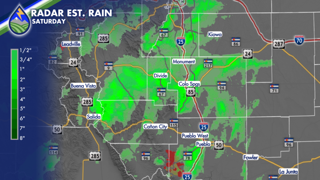
For Sunday, a few showers may be around the mountains during the morning, but the more organized storm activity is expected during the afternoon and into the early evening. Storms should develop first over the higher terrain, then spread across the I-25 corridor, the adjacent valleys, and out onto the eastern plains. Coverage looks more widespread than it did Saturday, especially across southern portions of the area.
The main concern today is heavy rain. Any storm that settles over one spot or repeatedly moves across the same area could produce a quick half-inch to inch of rain, and perhaps a little more in isolated spots. Small hail is possible, along with wind gusts in the 40 to 50 mph range. Those gusts can kick up quickly near stronger storms, but the rain is the bigger story with this monsoon pattern.
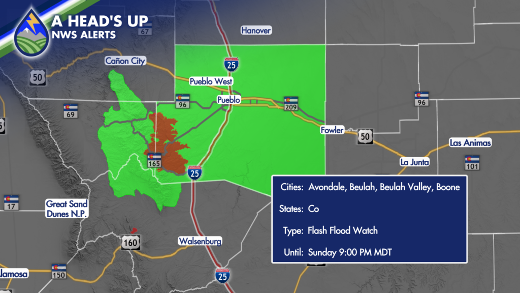
A Flash Flood Watch is in effect from 2 p.m. until 9 p.m. Sunday for the Aspen Acres burn scar area. Storms developing near or moving across the burn scar could produce dangerous runoff and flash flooding. If you live nearby, are traveling through the area, or have outdoor plans close to drainages and low-water crossings, keep a close eye on the sky this afternoon. It does not take a widespread rain event to create a problem near a burn scar; one stronger storm in the wrong place can do it.
Temperatures stay warm again today, generally in the 80s and 90s for lower elevations. Mountain locations above about 8,000 feet will be cooler, but they will also be among the first places to see showers and thunderstorms develop. The heat of the day will help storms build, so the best window for outdoor plans is generally earlier in the day. By mid- to late afternoon, plan on keeping an eye on radar, especially if you are heading into the mountains, along Interstate 25, or east onto the plains.
Around Colorado Springs, storms may begin to develop over and near Pikes Peak before spreading across the metro during the afternoon and early evening. Not every neighborhood will get rain, but the neighborhoods that do get under a slower-moving cell could see a quick downpour. Pueblo and areas south of Highway 50 also have the potential for storms, with locally heavy rain possible as cells move off the higher terrain and shift eastward. Monday looks very similar. Temperatures change very little, perhaps running a degree or two warmer in some spots, while monsoon moisture remains in place. Expect another round of afternoon and evening showers and thunderstorms, again beginning over the mountains and spreading toward the Interstate 25 corridor and plains. Storms will use daytime heating to get going, so the middle to later part of the afternoon will be the time to watch.
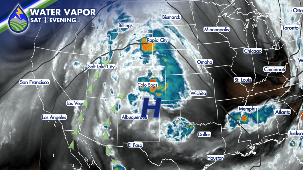
The broader pattern does not show a major change through the middle of the week. Daily chances for showers and thunderstorms continue, with the better storm coverage expected through Wednesday. That does not mean it will rain everywhere every day, but it does mean the afternoon forecast will continue to include the possibility of a quick downpour, lightning, gusty winds, and locally heavy rain. Keep the rain gear handy, and give yourself some flexibility for outdoor plans. Later in the week, the monsoon pattern looks to break up a little. Storm coverage should gradually trend downward Thursday and Friday, though afternoon storms will not disappear completely. Temperatures remain on the warm side overall, especially across the plains, with warm afternoons continuing even as storm chances become a little less widespread.






