


WINDY WEDNESDAY: As a system approaches on Wednesday a strong jet streak will move over Colorado. We’ll be in the right exit quadrant.
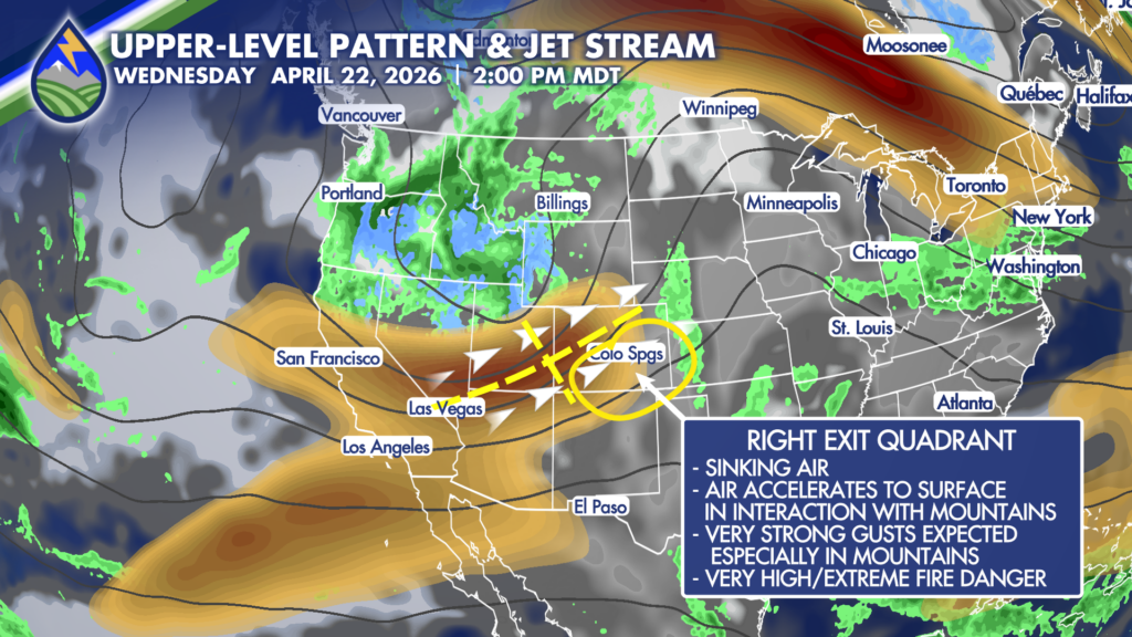
Think about dividing the jet streak on both it’s major and minor axes…quadrants are named based on their position relative to the wind flow (looking downstream) and whether they are in the entrance (upstream) or exit (downstream) region. The four quadrants are: Left Entrance, Right Entrance, Left Exit, and Right Exit.
This orientation on Wednesday is almost perpendicular to the Sangre de Cristo and Wet Mountains. The large scale pattern and terrain interaction will allow stronger wind aloft to descend to the surface…strengthening lee trough at the surface will assist in creating strong wind gusts too.
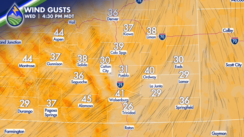
This will be a very high fire danger day over southern Colorado with dry, gusty wind developing through the day.
Are you ready? Did you know Peak Alerts notify you of emergency situations that are a threat to life or property in El Paso and Teller Counties? Examples include natural or man-made disasters, hazardous materials incidents, missing persons, law enforcement activity impacting the public, evacuation notices, and more. Register at PeakAlerts.org. Other jurisdictions may use different notification methods. Your county sheriff office is the best place to start when seeing how official notifications would work during a wildfire where you live.


