


WIDESPREAD WATER
The system coming in from the north for Wednesday night and Thursday and another system passing to our south on Friday combine with surface upslope to bring a stretch of weather that we haven’t seen for a bit in Colorado. Widespread rain and snow is on the way!
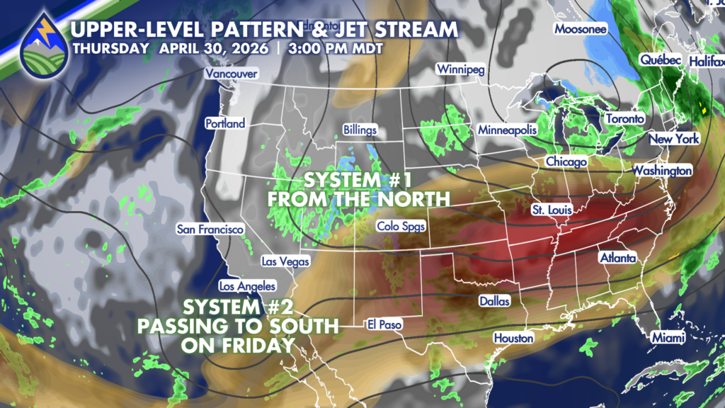
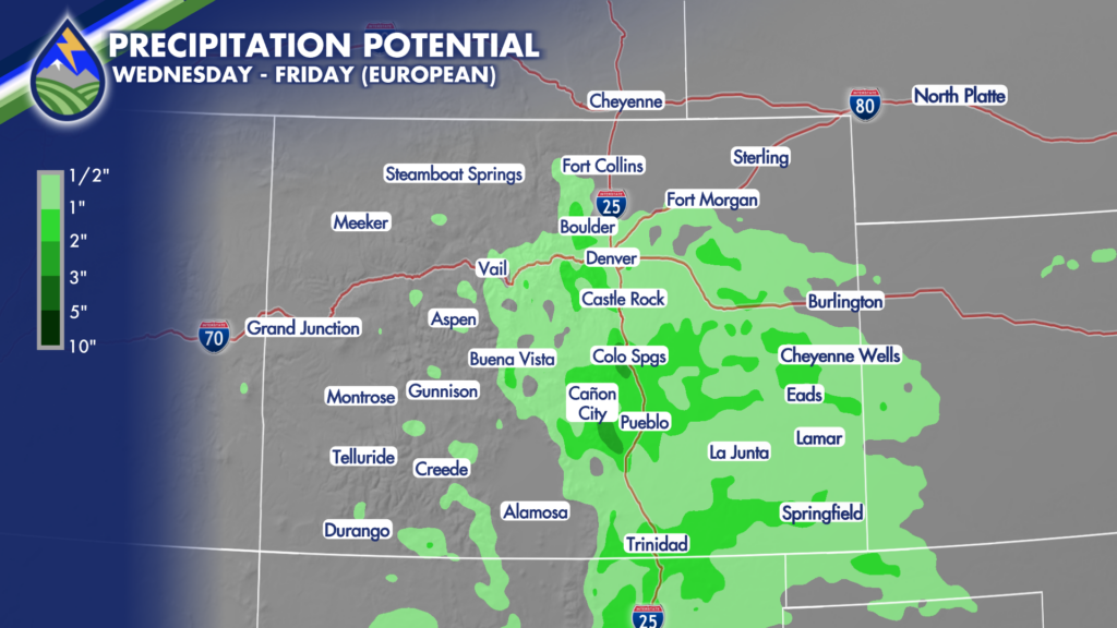
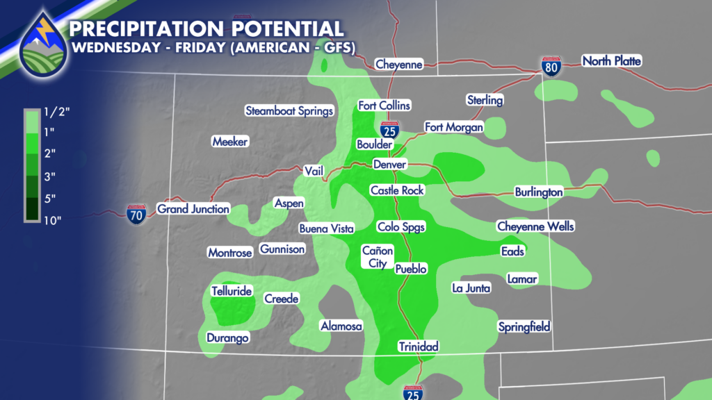
It still looks likely that a really good chunk of Colorado gets 1/2″-1.5″ of liquid from late Wednesday through late Friday. Given the combination of the the upper-level waves and surface upslope flow into the Rockies, the eastern Mountains and adjacent plains are likely to have the heaviest rain and snow. We continue to see some pretty consistent numbers in the numerical guidance suite even though some of the large scale details have changed a bit over the last four days.
What do I mean? Well, over the weekend it looked like the second system, the one coming in from the Pacific was going to be the bigger player. Now it looks like the northern wave is going to be the primary driver, but the result doesn’t change too much. Thankfully….you know we need the water.
Here’s a look at two different model outputs from Wednesday afternoon through dinner on Friday. The European model has a higher resolution (9km) compared to the American GFS (25km) model I’m showing you so that’s why you see more detail in the first one…but the pattern is generally the same…and that’s what we want to focus on.
POTENTIAL SNOW
Don’t get hung up on the details here…but the PATTERN is right. The higher terrain of southern Colorado is going to get some snow through the end of the week. For areas below 8,000′ the main window is Thursday night and early Friday when the snow level will get down to about 6,000′.
Even Colorado Springs proper is likely to see some big, wet flakes Friday morning. Accumulation is going to hug terrain and be elevation dependent but I wanted to get you ready.
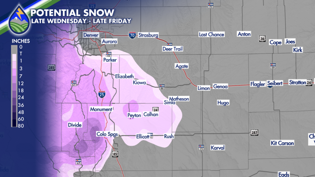

Mountains southwest of Pueblo are going to catch snow too, and some of it is likely going to be heavy over the Wet and Sangre de Cristo mountains. The Walsenburg to Trinidad stretch is too high on what I’m showing you here, FYI, I’ll refine that over the next 24 hours.
Be ready for the incoming storm with the Peaks2Plains Weather app. We’ve got detailed information for where you are! Impacts, timing is all covered. Use the “Days Ahead” and click on the days for our detailed text about what we expect in your neighborhood!
APPLE: https://apps.apple.com/us/app/peaks2plains-weather/id6756083668
ANDROID: https://play.google.com/store/apps/details?id=com.peaks2plains.android.weather


