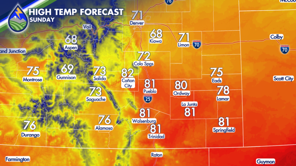
Drying Trend in The Mountains
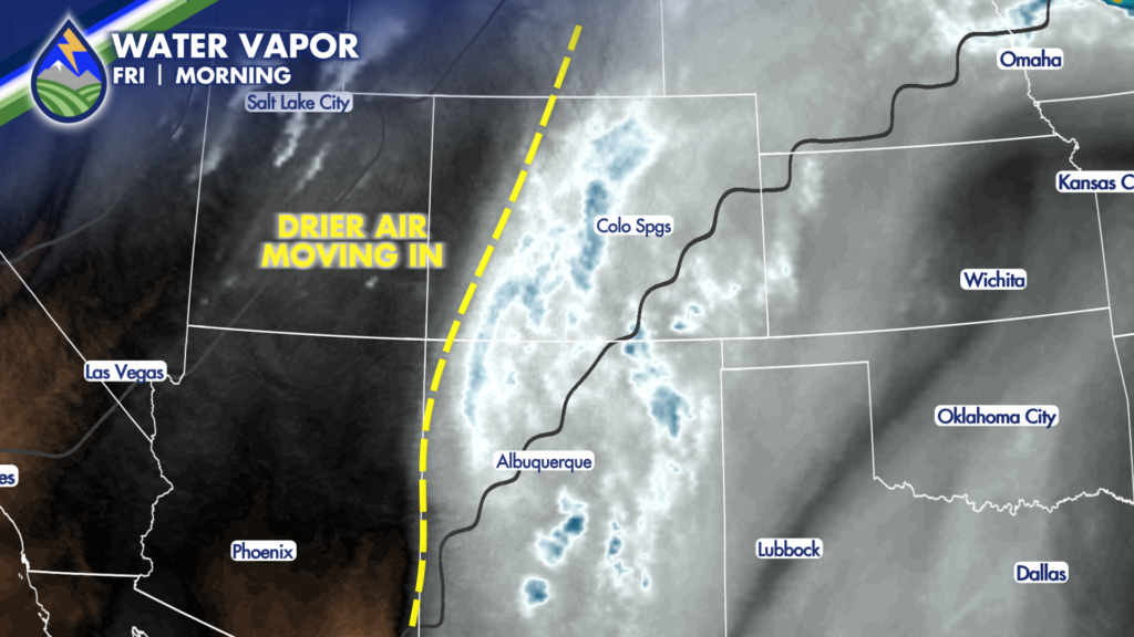
Mountain temperatures may run a degree or two warmer than yesterday as some drier air begins working in from the west. A small disturbance moving north from New Mexico may help spark a few mountain showers and thunderstorms. Any storm that develops could briefly produce moderate to heavy rain, though coverage will be scattered and many spots will stay dry.
Storm Chances Over The Plains
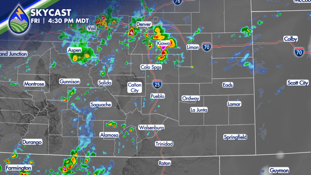
The bigger weather feature Friday is a cold front dropping south from Wyoming late in the day. As it reaches northeastern Colorado and the Palmer Divide, thunderstorm chances increase from the Pikes Peak region east through Lincoln County and toward the I-70 corridor. That is the area most likely to see late-day showers and storms. A storm or two farther south cannot be ruled out, but chances decrease as you head south.
For Colorado Springs, Monument, Falcon, Peyton, and communities across northern and northeastern El Paso County, keep an eye on the sky during the late afternoon and evening. A few storms northeast of Colorado Springs could put down a decent burst of rain. Storms will be scattered, so not everyone gets rain, but outdoor plans may need a little flexibility. If thunder is nearby, head indoors and wait it out.
As the front continues south Friday night, there could be a stray shower or sprinkle in other parts of Southern Colorado. It is not the most likely outcome, but it is worth keeping in mind if you have evening plans, are traveling, or are spending time outdoors. The main thunderstorm activity should gradually wind down through the night.
Severe Storms Possible Saturday
Saturday brings a reinforcing shot of cooler air, especially for northeastern Colorado. That should make 90-degree temperatures less likely across Southern Colorado. The mountains continue trending drier overall, and any Saturday mountain storms should generally favor areas north of Highway 50. Much of the southern part of the state looks dry.
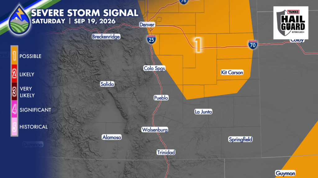
The better Saturday storm focus again shifts toward the Palmer Divide, northeastern El Paso County, and points northeast toward Kit Carson County. Storms are most likely from the afternoon into the evening, though they will still be scattered. Not every neighborhood, town, field, or highway stretch will see a storm. The farther south you go, the lower the storm coverage and the weaker storms generally look.
A couple of Saturday storms from around Colorado Springs toward Kit Carson and northward could be strong. The primary concern would be wind gusts around 60 mph, with a possibility of hail around three-quarters of an inch to near one inch in diameter. Those stronger storms are tied to the incoming cooler air. Storms farther south would tend to be weaker, and any later-day or evening storms that develop farther south are not expected to be severe.
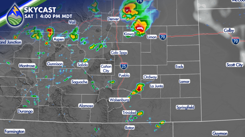
If you’re going to be east of the Springs and along and north of the Arkansas River, keep the Peaks2Plains Weather app handy on Saturday.
Gusty thunderstorm winds can arrive quickly, even where rainfall is brief. Secure lightweight outdoor items, and avoid waiting in an exposed area when storms are approaching. Remember that lightning can strike well ahead of the rain shaft.
Sunday Storms Looking Possible For Some
Sunday looks cooler, with drier air continuing to move in from the west. The mountains should have a quieter day overall. There is still a possibility of a couple of storms, especially north of Highway 50, as the timing of the weekend fronts continues to matter. At this point, Sunday does not look like a day of widespread mountain storms, but we will continue refining the local details.