Blog
LONG_TERM OUTLOOK: Mid-March May Bring Active Stretch
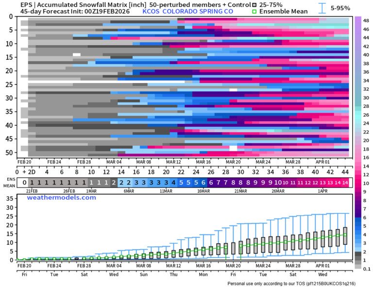
Our next chance at another active stormy stretch looks to be in the middle of March, unfortunately – somewhere in the 15th-20th timeframe. Ensemble means








Our next chance at another active stormy stretch looks to be in the middle of March, unfortunately – somewhere in the 15th-20th timeframe. Ensemble means
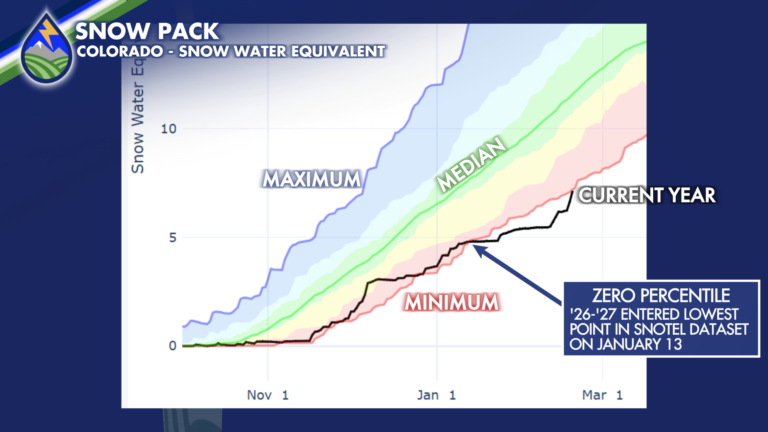
SO CLOSE! We’ve seen snow pack increase this week over the mountains, between 10-15% increase compared to median over the southern basins where we were
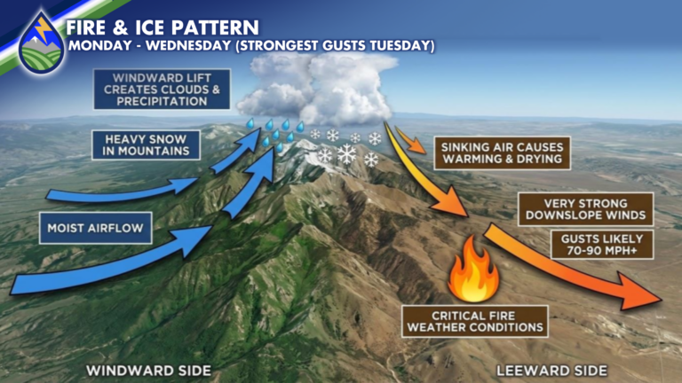
BY THE NUMBERS: Grids tell the story across different parts of the state over the next 48 hours. Crested Bute sees the wind and snow
NORTH OF HIGHWAY 50: From 5pm-12am is our most likely timeframe to catch showers. They will be lighter and less widespread than areas farther south.
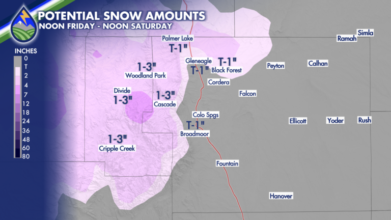
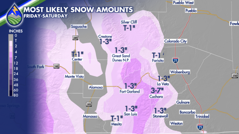
Late Friday and Saturday will bring some snow to the local higher terrain areas of southern Colorado. Between 8,000′-6,500′ I’d only expect it to be
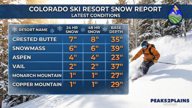
As expected, the central mountains around Crested Butte Mountain Resort and Aspen Snowmass led the way on the first wave of snow. We’ll have a
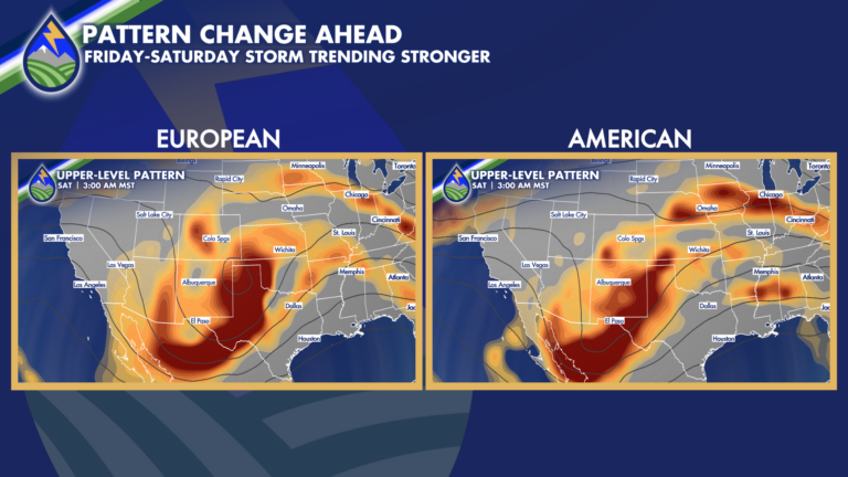
LATE WEEK PATTERN CHANGE: After the mountains get some snow Wed-Thurs we watch the main part of the late week pattern change I’ve been talking
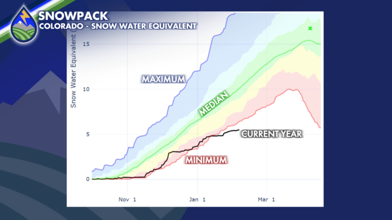
Snow pack (snow water equivalent) remains historically low – the bottom of the data set. I’ve zoomed in on a time-series graph showing the maxium,

With one big storm and a couple small snows, January was a snowy month in Colorado Springs. The storm on the 7th-9th put down 9-14″

UPPER-LEVEL PATTERN Sometimes potential just isn’t realized – it’s sorta like my college baseball career. In my case, it was too much beer, but for