Blog
Snow Pack Still Low – Heading Toward Peak – And Start of Melt Off
Even after a late-week snow storm heading into the first full-weekend of March, 2026, snow pack across Colorado remains at historical lows. The Arkansas River








Even after a late-week snow storm heading into the first full-weekend of March, 2026, snow pack across Colorado remains at historical lows. The Arkansas River
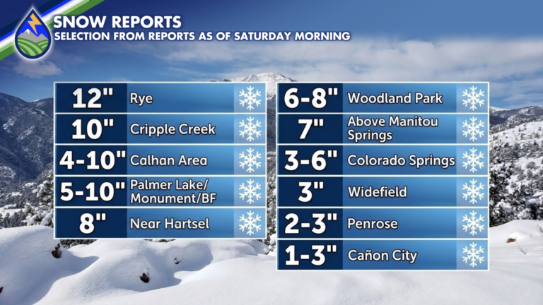
WELCOME SNOW! Here’s a selection of the reports I’ve received. Don’t be offended if you’re area isn’t included. For real. Things really varied in some
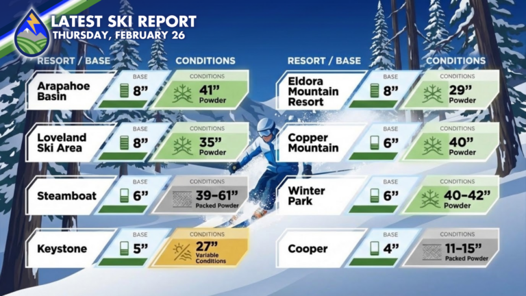
Latest numbers from the slopes this morning match up well with what I showed before it started snowing late Tuesday. It’s a nice refill if
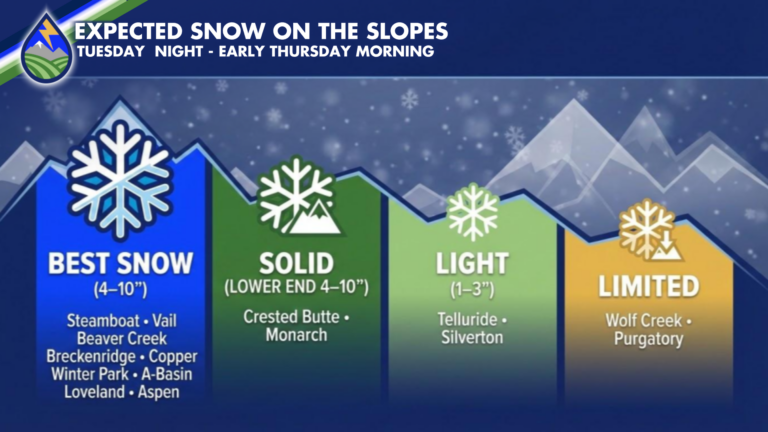
MORE SKI-RESORT SNOW: Snow is set to increase over the mountains later tonight and continues through Wednesday into Wednesday night. A general 4″-10″ (more in
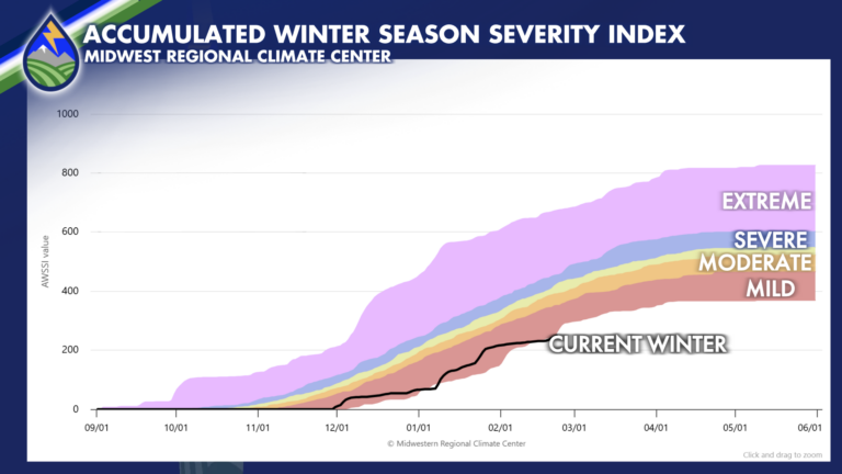
How does this winter compare to other winters in Colorado? Answering that question is challenging when you talk about trying to quantify it. Several researchers
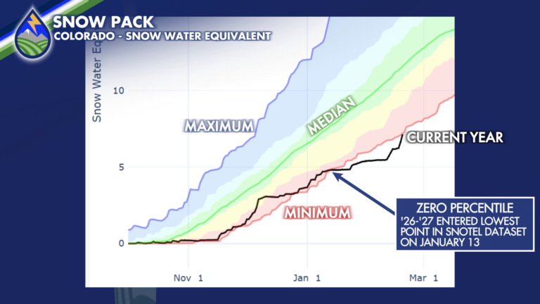
SO CLOSE! We’ve seen snow pack increase this week over the mountains, between 10-15% increase compared to median over the southern basins where we were
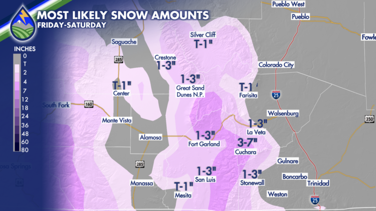
NORTH OF HIGHWAY 50: From 5pm-12am is our most likely timeframe to catch showers. They will be lighter and less widespread than areas farther south.
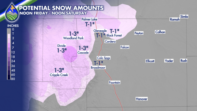
Late Friday and Saturday will bring some snow to the local higher terrain areas of southern Colorado. Between 8,000′-6,500′ I’d only expect it to be
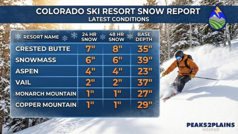
As expected, the central mountains around Crested Butte Mountain Resort and Aspen Snowmass led the way on the first wave of snow. We’ll have a
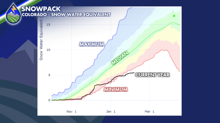
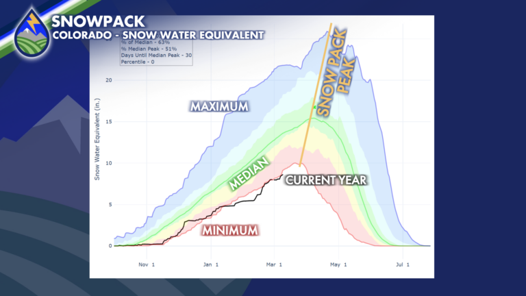
Snow pack (snow water equivalent) remains historically low – the bottom of the data set. I’ve zoomed in on a time-series graph showing the maxium,