Colorado Snow Pack Improves to Just Above Historic Lows, Arkansas Basin Only at 49%
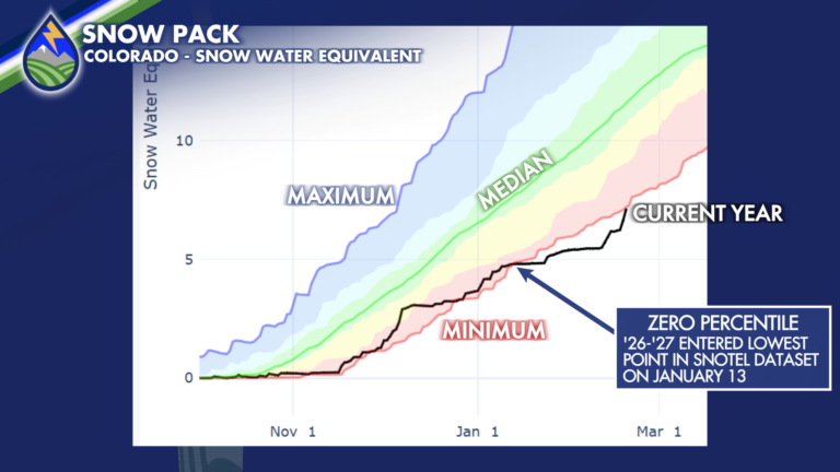
With the latest storm dropping between 4″ and 10″ of snow across mainly the central and northern mountains, Colorado’s statewide snow water equivalent snowpack has
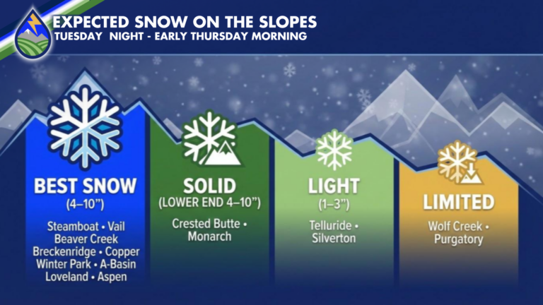
With the latest storm dropping between 4″ and 10″ of snow across mainly the central and northern mountains, Colorado’s statewide snow water equivalent snowpack has
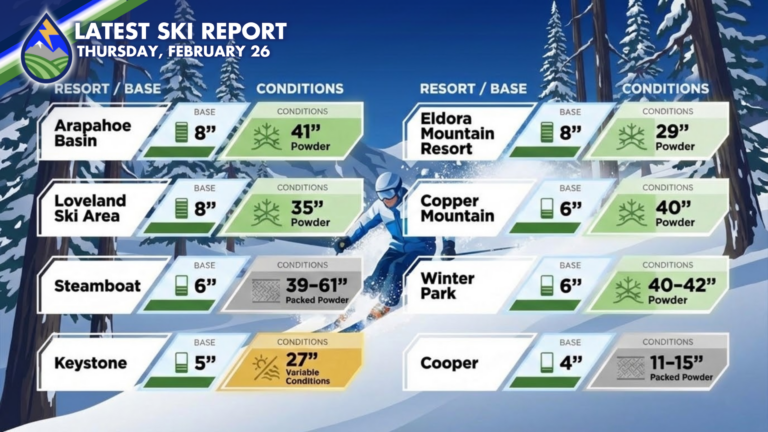
Latest numbers from the slopes this morning match up well with what I showed before it started snowing late Tuesday. It’s a nice refill if

MORE SKI-RESORT SNOW: Snow is set to increase over the mountains later tonight and continues through Wednesday into Wednesday night. A general 4″-10″ (more in

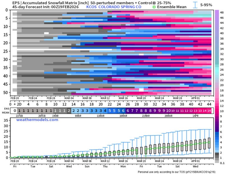
Our next chance at another active stormy stretch looks to be in the middle of March, unfortunately – somewhere in the 15th-20th timeframe. Ensemble means

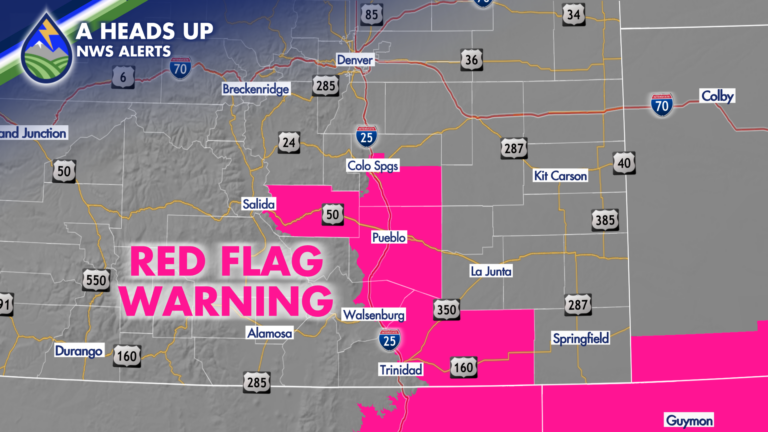
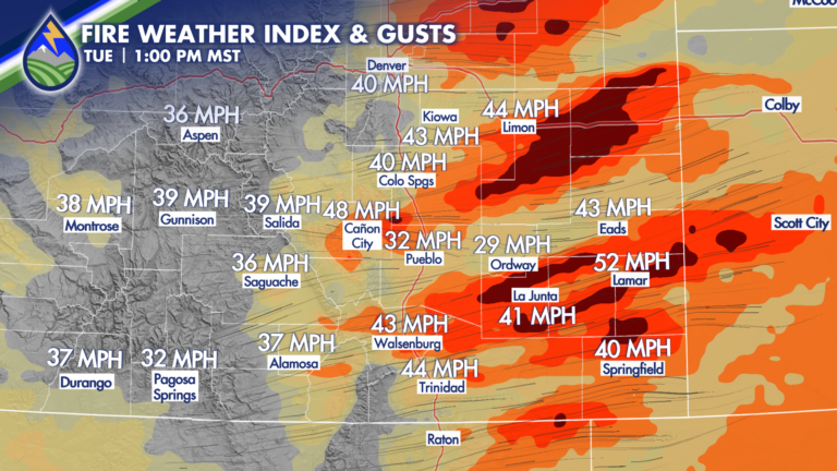
Another high fire danger day in parts of Colorado. The combination of wind gust potential in the afternoon between 30-45 mph and relative humidity levels

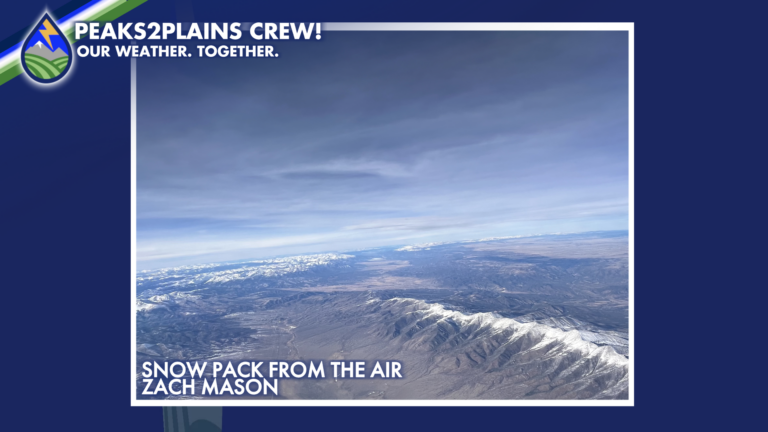
SO CLOSE! We’ve seen snow pack increase this week over the mountains, between 10-15% increase compared to median over the southern basins where we were

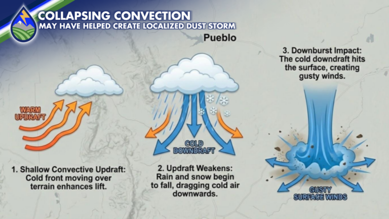
COLD FRONT PASSAGE On the large scale, the tragic, deadly pile-up on Interstate 25 south of Pueblo, Colorado on Tuesday, February 17, 2026 was the

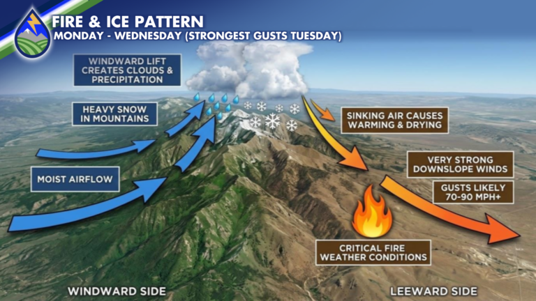
CRITICAL FIRE DANGER: A strong jet streak will drive a Pacific cold front across Colorado Tuesday. The front will move over the mountains early in

BY THE NUMBERS: Grids tell the story across different parts of the state over the next 48 hours. Crested Bute sees the wind and snow

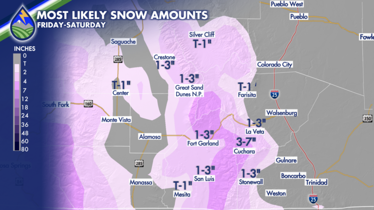
NORTH OF HIGHWAY 50: From 5pm-12am is our most likely timeframe to catch showers. They will be lighter and less widespread than areas farther south.