Blog
Ensembles Point to Early Week Storm
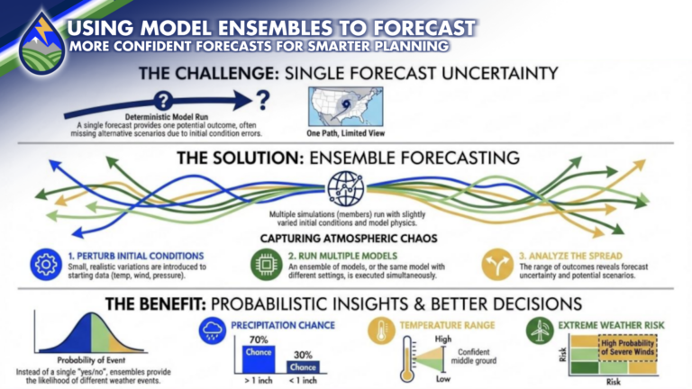
NEXT WEEK’S STORM: Confidence in a storm moving through the area next week is high because not only do I see it in the individual


NEXT WEEK’S STORM: Confidence in a storm moving through the area next week is high because not only do I see it in the individual
We’re heading into a stretch where the pattern finally starts to shift—and it’s going to matter for how the rest of the week and weekend
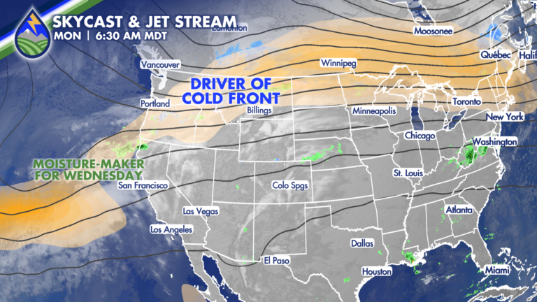
Ahead of the Front: Monday’s Warmth and Fire Danger Monday is all about what’s happening ahead of the cold front—and it still looks and feels
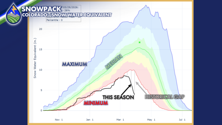
A couple things about our snow pack that has lost about 3.5-4.5 feet’s worth in the last two and half weeks…Here’s a forecast I made
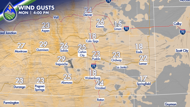
LESS WIND SUNDAY: Wind picks up on Monday out of the west and that one sharp difference increases fire danger. My friends at US National
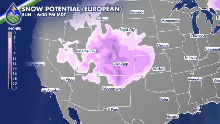
While there is some uncertainty (models will always have this a week or more out) as you can see the European and American models for
The front keeps pushing west this evening and temperatures will continue to drop….we’ll maintain an outside chance of a gusty type thunderstorm for the next

As of 9am Thursday Morning, March 26, the 24Fire is 61% contained, with containment on the west, south, and southeast sides…great news for the wind
24 FIRE: Just did 20 minutes of live coverage to talk about the visible flare up and to share straight from the fire line what’s
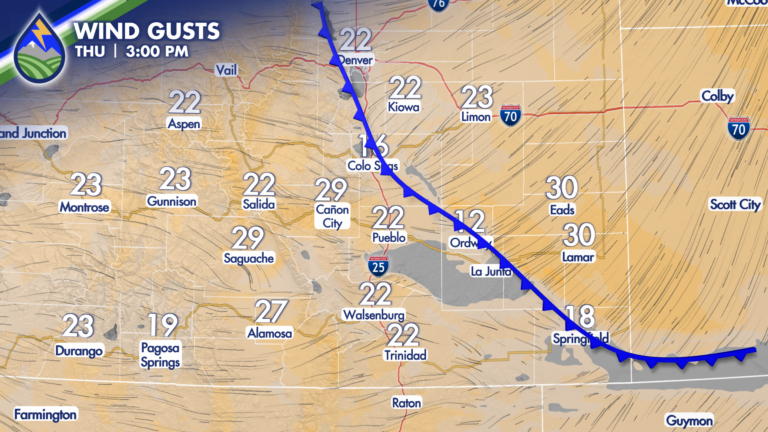
HUGE CHANGE! We’re going to go from records and fire danger Thursday to 40° degrees colder Friday east of the mountains. We’ll get cooler over