Blog
Cold Front Arriving Saturday, Big Changes Sunday
COLD FRONT ARRIVING We take the edge off today from Friday’s heat! It’ll be breezy as the front arrives from the north. Where the front








COLD FRONT ARRIVING We take the edge off today from Friday’s heat! It’ll be breezy as the front arrives from the north. Where the front
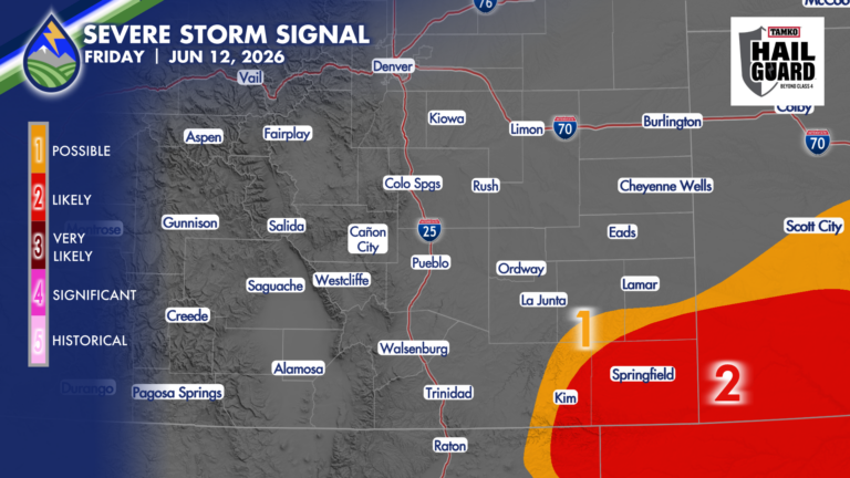
SEVERE STORMS FRIDAY Severe thunderstorms over eastern Las Animas County, southern Bent and Prowers Counties, and Baca County are likely to develop today between 2:30-4pm,
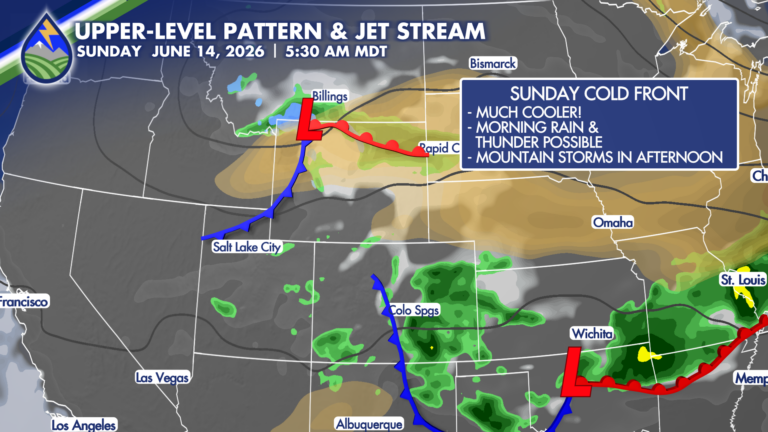
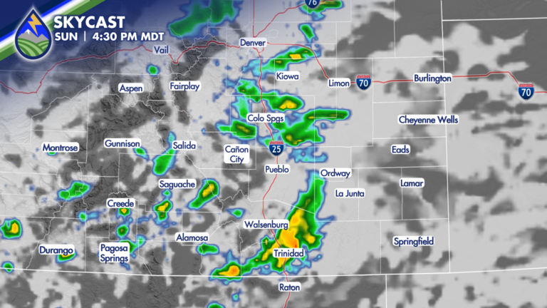
A cold front moving south over the area Saturday night may bring some early morning showers, and perhaps some thunder to start Sunday. That’s rare
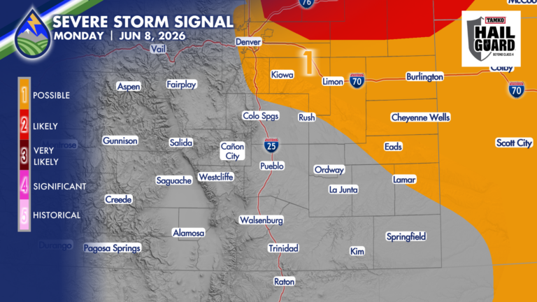
I’ve got some questions as to exactly where the cool front and the low-level moisture behind it end up. It’s important…it’s going to drive where
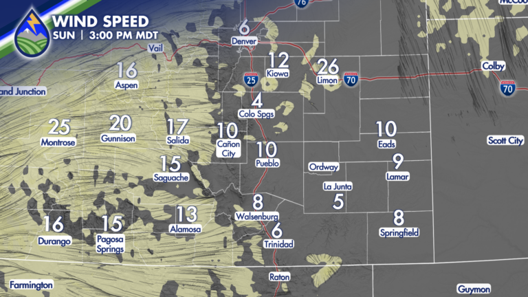
Early low clouds over parts of the plains will clear through mid-morning as drier air moves in from the west. By the afternoon dewpoint
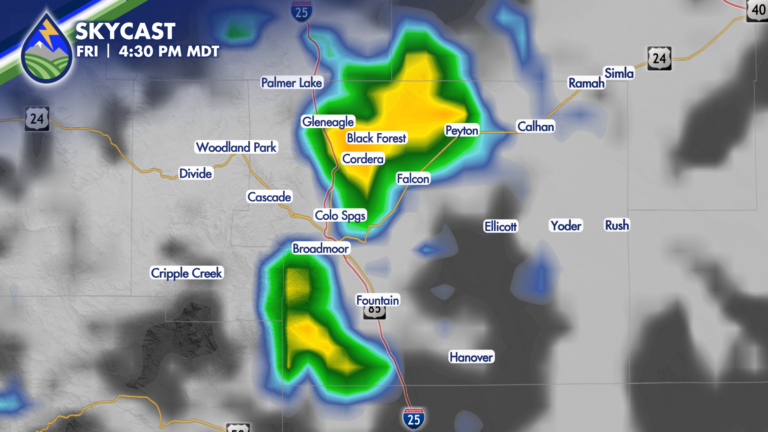
The best chance of storms Friday afternoon are going to come in the Pikes Peak Region. Storms that form in Teller County will get stronger
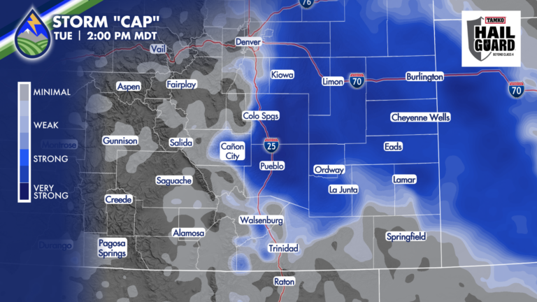
STORM CHALLENGES TUESDAY While we lack the wave that was moving across northern Colorado yesterday, we still have wind shear with east wind at the
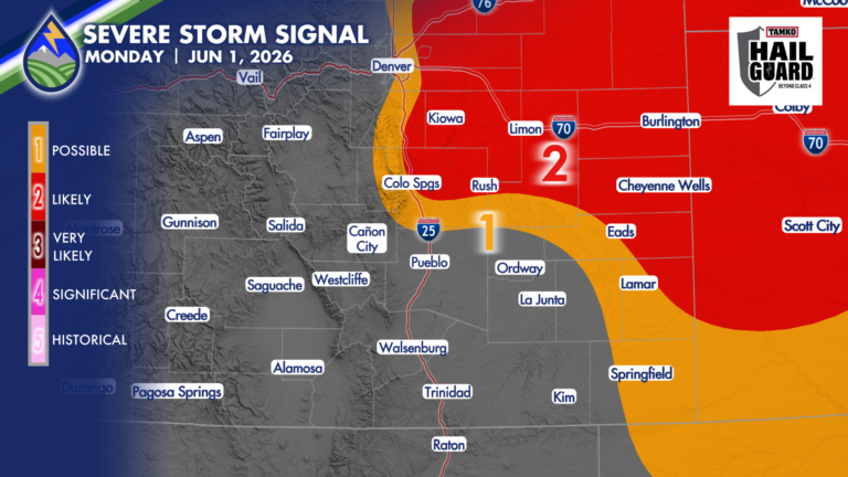
*UPDATE* SEVERE STORM POTENTIAL As the area of low pressure is spinning up over southern Colorado now, I’ve pulled our chances for severe storms back
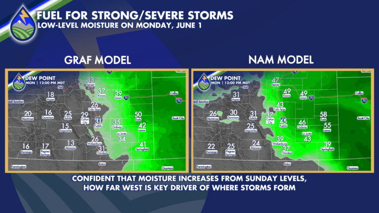
June begins with a return of low-level moisture into eastern Colorado that begins early Monday morning. How far west, and how “deep” this moisture is
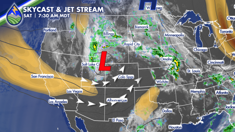
WELCOME TO THE WEEKEND! We’ll get breezy today with an upper-level system passing to our northwest and jet-streak rotating in around the south side of