Blog
Next storm to bring more welcome rain/snow
OUR NEXT STORM Another moisture maker eyeing Colorado late this weekend and early next week. The storm is trending farther south – which is good








OUR NEXT STORM Another moisture maker eyeing Colorado late this weekend and early next week. The storm is trending farther south – which is good
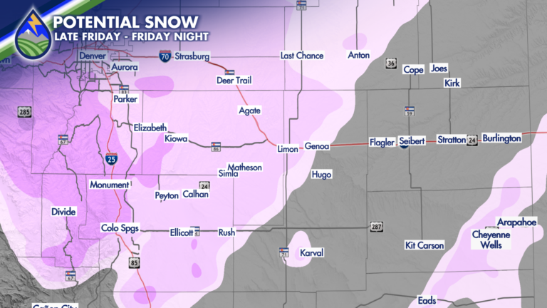
Friday afternoon into Friday night snow is looking more likely for #Denver, #ColoradoSprings, the foothills and the Palmer Divide. The second storm of the week
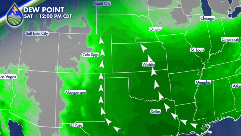
We’re heading into a stretch where the pattern finally starts to shift—and it’s going to matter for how the rest of the week and weekend
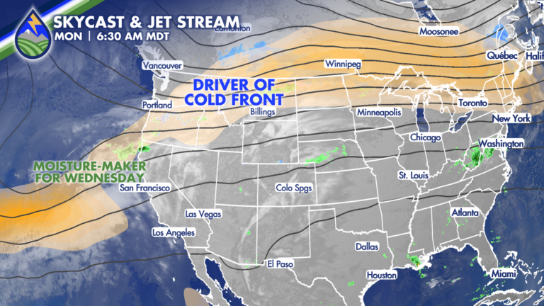
Ahead of the Front: Monday’s Warmth and Fire Danger Monday is all about what’s happening ahead of the cold front—and it still looks and feels
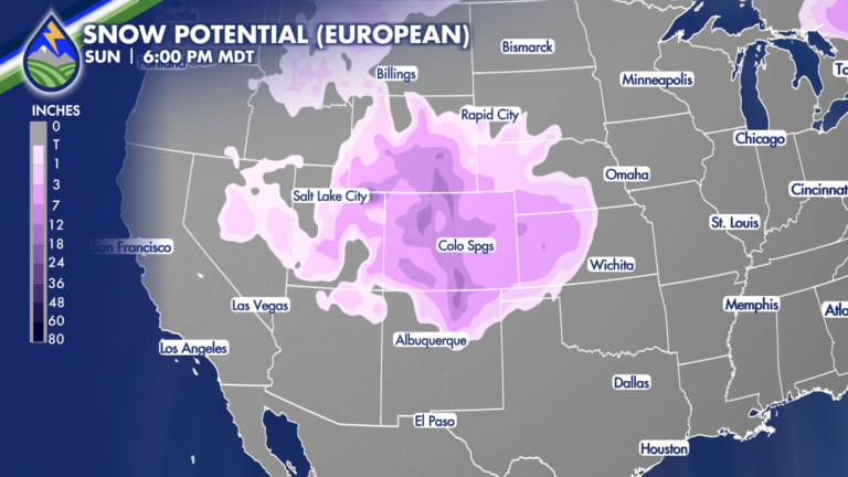
While there is some uncertainty (models will always have this a week or more out) as you can see the European and American models for
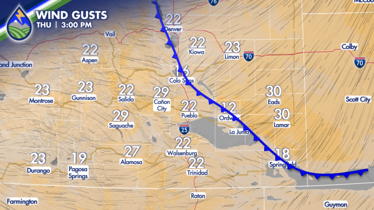
The front keeps pushing west this evening and temperatures will continue to drop….we’ll maintain an outside chance of a gusty type thunderstorm for the next
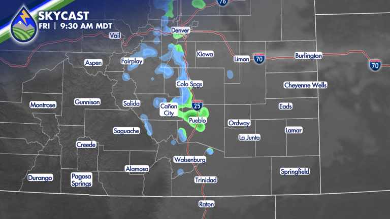
HUGE CHANGE! We’re going to go from records and fire danger Thursday to 40° degrees colder Friday east of the mountains. We’ll get cooler over
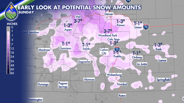
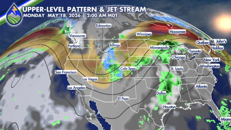
A strong cold-front will be pushed through Colorado by a jet-streak early Sunday morning to bring huge changes to the area for the back half
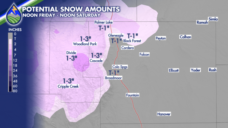
Late Friday and Saturday will bring some snow to the local higher terrain areas of southern Colorado. Between 8,000′-6,500′ I’d only expect it to be

I’ve upped snow amounts for a few areas due to how I expect the storm to evolve into early Friday morning. Areas over the southeast