Blog
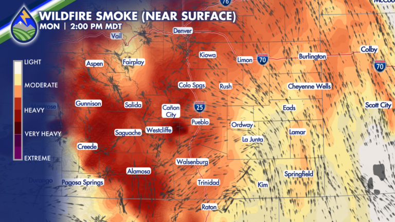
Smoke Thicker Over Mountains Monday
SMOKE FORECAST The mountain plains circulation is driving our large-scale weather pattern the next several days…that means upslope during the afternoons so the heaviest smoke








SMOKE FORECAST The mountain plains circulation is driving our large-scale weather pattern the next several days…that means upslope during the afternoons so the heaviest smoke
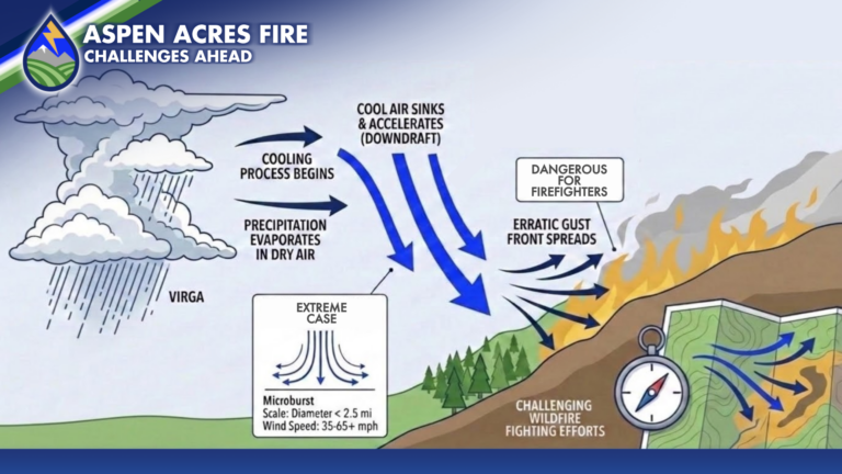
ASPEN ACRES FIRE UPDATE (SUNDAY MORNING) Crews reported a good day on the fire Saturday behind the cold front and were able to aggressively attack
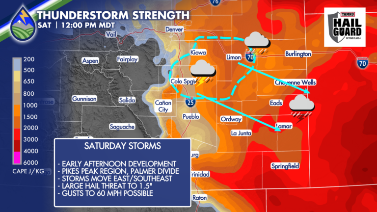
SEVERE STORMS SATURDAY Behind an overnight cold front to welcome the holiday weekend, storm initiation is looking more likely to be in the Pikes Peak
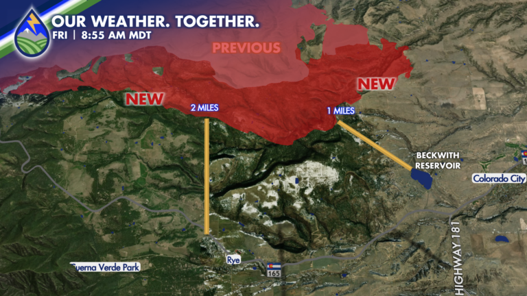
FRIDAY 9AM I was able to get the new growth from last night onto the map here showing the additional growth overnight on the north
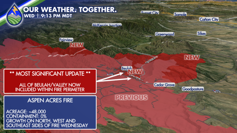
IMPORTANT UPDATE The newest perimeter of the fire now includes all of the Beulah/Valley area where previous updates had the fire ringing the community. It
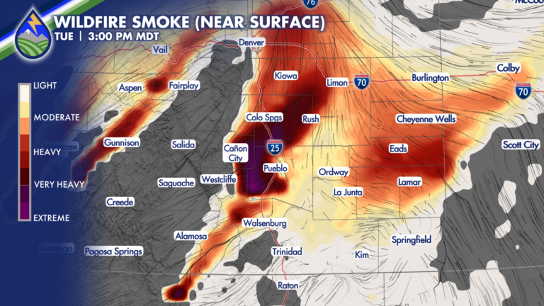
SMOKE TO INCREASE As fire activity increases with the heat of the day and the strongest wind, smoke will become an issue again. With the
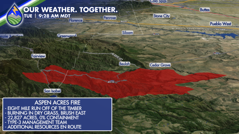
Activity will increase over the fire in the next several hours as we warm up and wind begins increasing on the large scale. Fire behavior
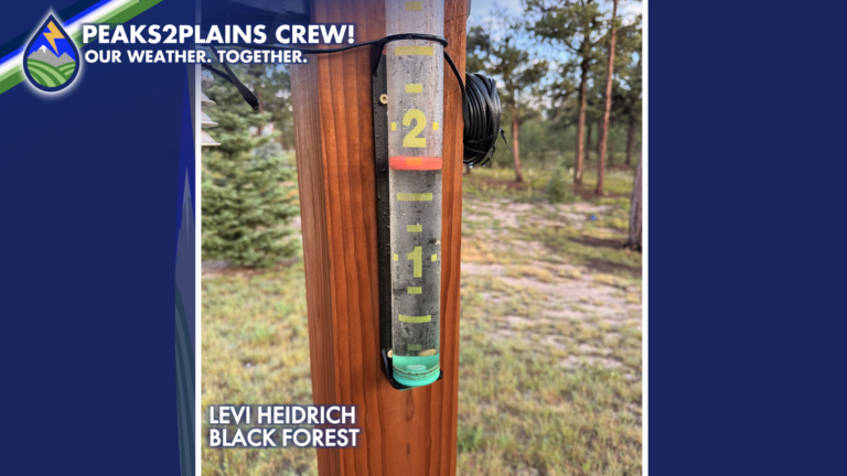
Several rounds of showers and thunderstorms produced widespread beneficial rainfall across portions of the Peaks2Plains coverage area on Thursday into early Friday morning. The heaviest
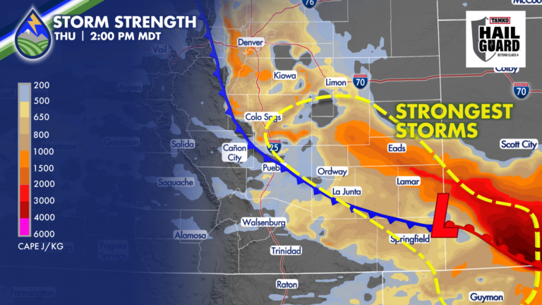
There is always a level of uncertainty with weather forecasts. It’s usually different aspects of the forecast each day, and for today, here’s what I’m
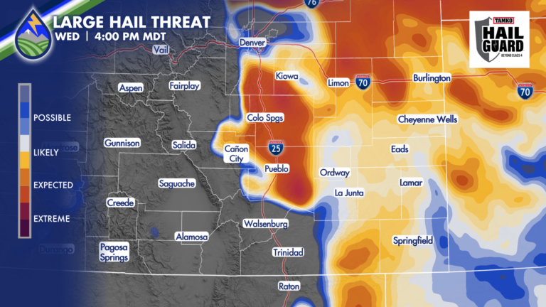
HERE WE GO, AGAIN Well crew, the moisture isn’t mixing out and we’ve got a wave coming in from the west….so we’re looking at severe