Blog
Severe Storms or High Fire Danger on Saturday
Severe Storms or High Fire Danger Saturday Welcome to your weekend! A system passing over Colorado and Wyoming on Saturday is going to make for


Severe Storms or High Fire Danger Saturday Welcome to your weekend! A system passing over Colorado and Wyoming on Saturday is going to make for
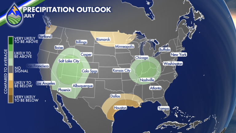
As we head toward the back half of 2026, we’re into an El Niño that looks to strengthen in the months ahead. While El Niño
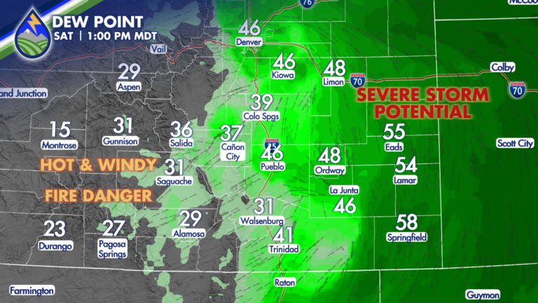
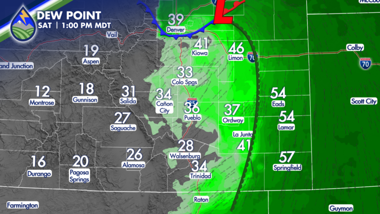
SIGHTS ON SATURDAY Your weekend begins with a very interesting weather day. As a system approaches the region from the west, scheduled to move across

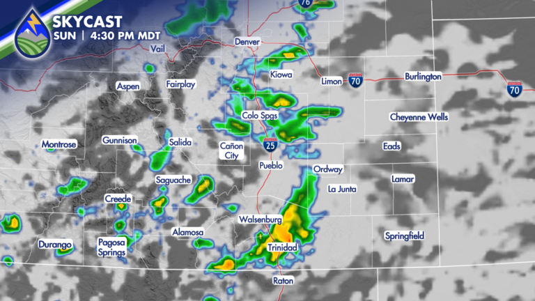
STORM CHANCES MONDAY Low-level moisture is still around this afternoon behind the cold front that gave us highs in the 60s and 70s on Sunday.
COLD FRONT ARRIVING We take the edge off today from Friday’s heat! It’ll be breezy as the front arrives from the north. Where the front
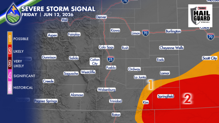
SEVERE STORMS FRIDAY Severe thunderstorms over eastern Las Animas County, southern Bent and Prowers Counties, and Baca County are likely to develop today between 2:30-4pm,
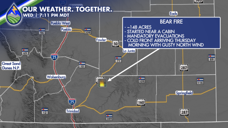
BEAR FIRE: Merry and I were honored to have Linda Rush and Chaz Wakeman, who are evacuated from their homes in the path of the

Utah was blowing and Kansas was sucking yesterday and we were the windy spot between! There was sand in the air, there was dust in
HAIL NEAR 2″ POSSIBLE I’m watching northeast El Paso County and the Palmer Divide today for a supercell thunderstorm or two that may produce very
I’ve got some questions as to exactly where the cool front and the low-level moisture behind it end up. It’s important…it’s going to drive where