Blog
Severe Storms Possible Friday Afternoon
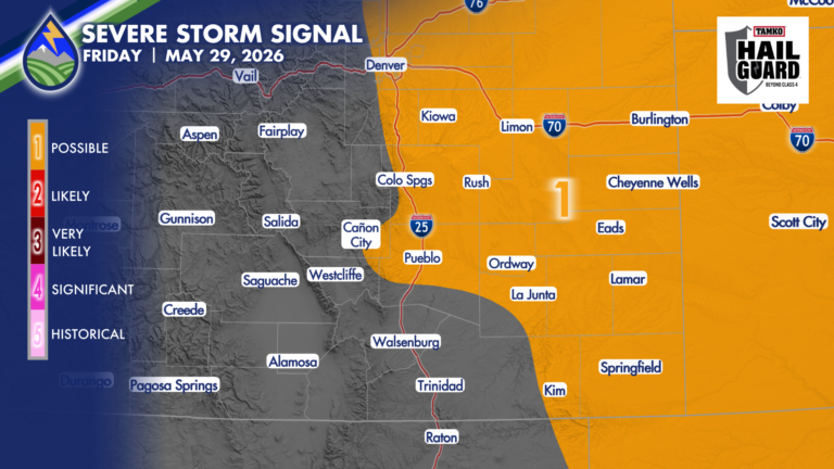
SEVERE STORMS POSSIBLE FRIDAY Drier air working in from the southwest and very moist air at the surface east of the Rockies this morning do








SEVERE STORMS POSSIBLE FRIDAY Drier air working in from the southwest and very moist air at the surface east of the Rockies this morning do

The storm in southern Otero County Thursday evening had a couple scans where it looked like it had potential for some hail near one inch.
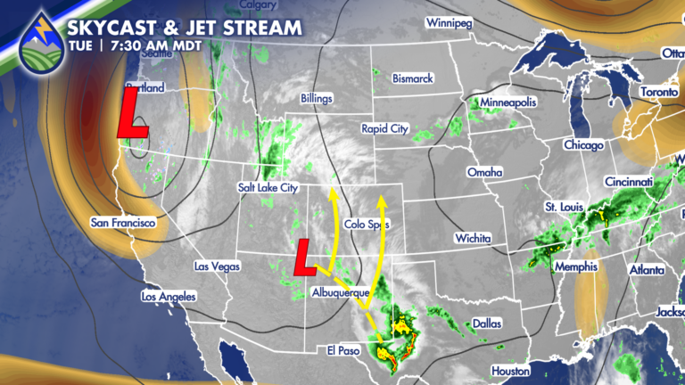
A large area of low pressure over the west coast will steer an upper-level system up from the south over the next couple of days
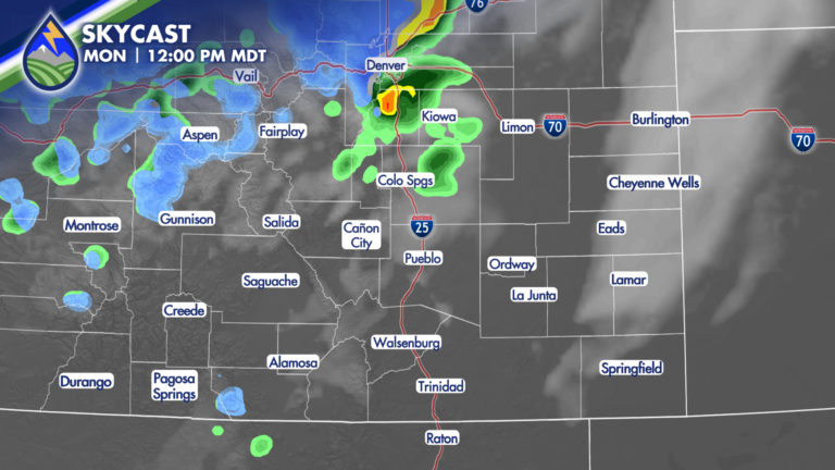
SHOWERS/STORMS MOVING NORTHEAST Showers and thunderstorms on the western slope Monday morning will move to the northeast today. Here’s what to know: SAN LUIS
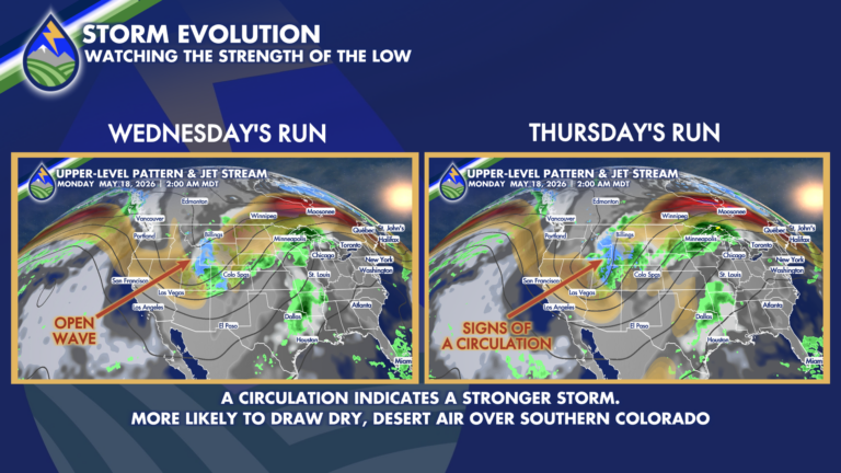
One of the things we’re working on for the storm in the late Sunday through Tuesday time frame is the likelihood of the storm to
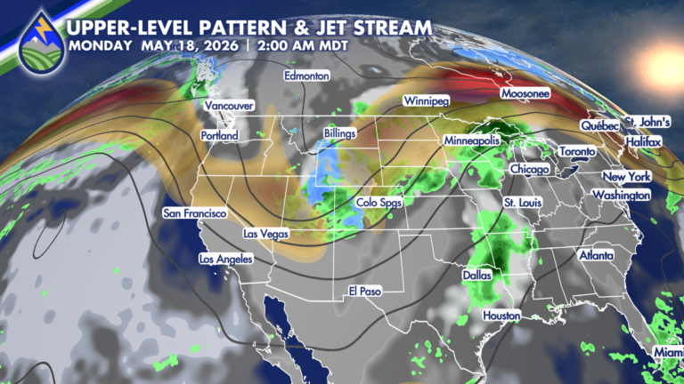
OUR NEXT STORM Another moisture maker eyeing Colorado late this weekend and early next week. The storm is trending farther south – which is good
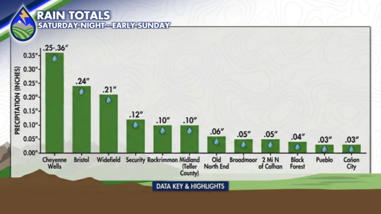
Here’s a look at CoCoRaHS reports and radar estimated rain for the overnight and early mornings showers and thunderstorms. See that bright green strip just to
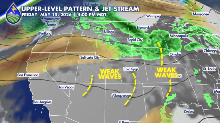
Later this week we get a few subtle waves to move through the atmosphere. Each of these brings a pocket of slightly cooler air aloft
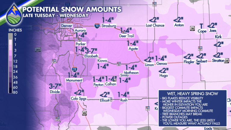
HOW MUCH SNOW?: Tell me…for real! This one is HARD – especially between 6,000′-8,000′. Take one thing from this…what falls and what you measure are
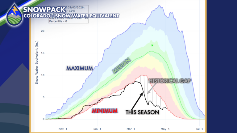
SNOWPACK Check this out…the storm last week did a nice job of making up some of the historical gap from the previous minimum snowpack…we’re not