Blog
Mid-week Changes Don’t Last
COOLDOWN A brief cool down of about ten degrees today east of the mountains. Enjoy it because it doesn’t last long…we bump back up








COOLDOWN A brief cool down of about ten degrees today east of the mountains. Enjoy it because it doesn’t last long…we bump back up
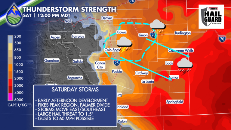
SEVERE STORMS SATURDAY Behind an overnight cold front to welcome the holiday weekend, storm initiation is looking more likely to be in the Pikes Peak
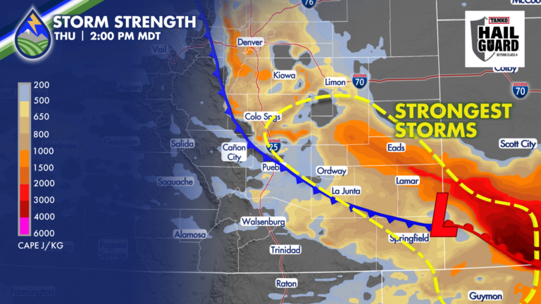
There is always a level of uncertainty with weather forecasts. It’s usually different aspects of the forecast each day, and for today, here’s what I’m
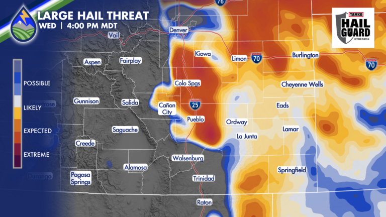
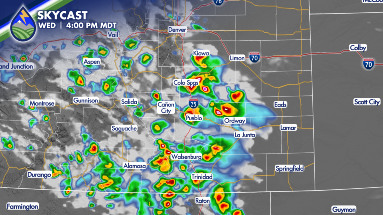
HERE WE GO, AGAIN Well crew, the moisture isn’t mixing out and we’ve got a wave coming in from the west….so we’re looking at severe
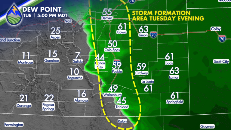
STRONG NIGHTTIME STORMS An atypical pattern for Colorado is likely tonight with very large hail possible in the cities. Isolated storms east of the
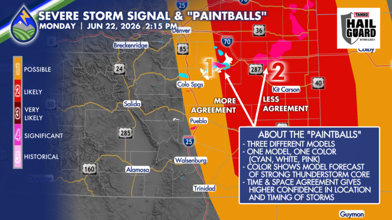
USING “PAINTBALLS” Behind the scenes we’re always using multiple computer models to look at a range of possible solutions for expected weather, and combining that
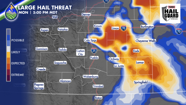
LARGE HAIL DAY MONDAY Storms may not really take off until the middle to late afternoon on Monday, but when they do, high impacts are
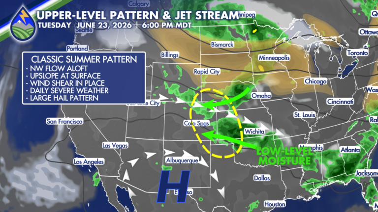
CLASSIC PATTERN EARLY IN THE WEEK Low-level moisture moving up the slope toward the Rocky Mountains and northwest flow aloft riding a ridge to our
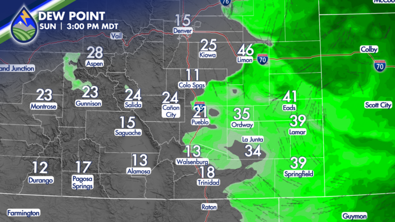
Low-level moisture is lower this afternoon and there is less oomph in the mid-levels of the atmosphere compared to Saturday. It means fewer storms
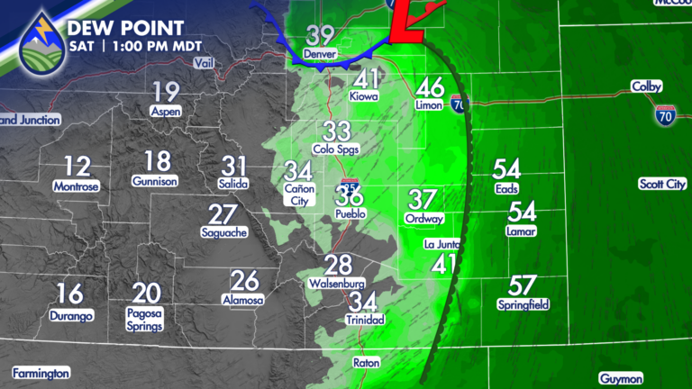
Severe Storms or High Fire Danger Saturday Welcome to your weekend! A system passing over Colorado and Wyoming on Saturday is going to make for