Blog
Breezy Start to Weekend
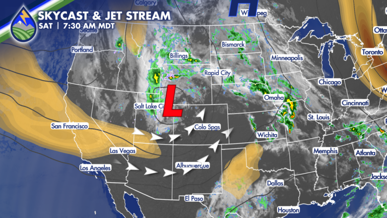
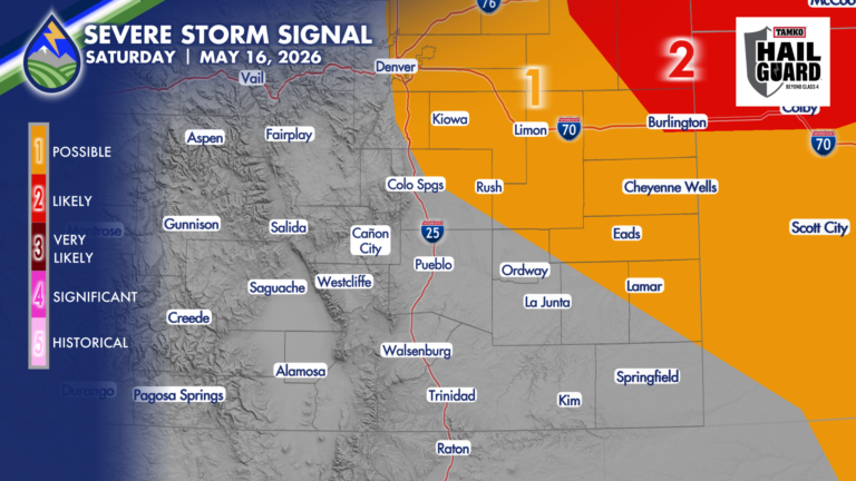
WELCOME TO THE WEEKEND! We’ll get breezy today with an upper-level system passing to our northwest and jet-streak rotating in around the south side of








WELCOME TO THE WEEKEND! We’ll get breezy today with an upper-level system passing to our northwest and jet-streak rotating in around the south side of
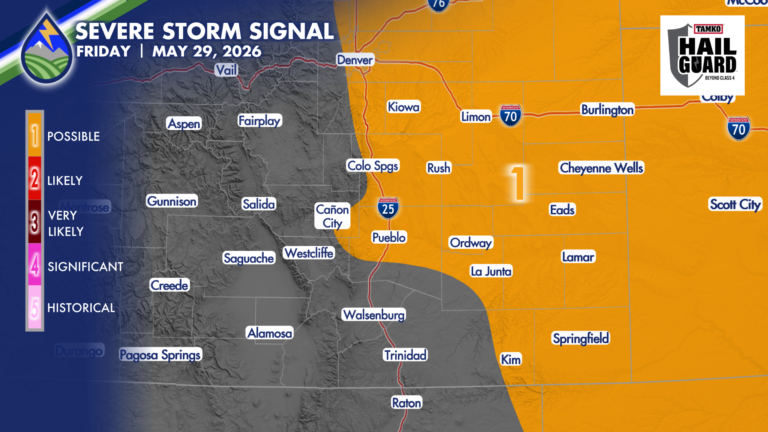
SEVERE STORMS POSSIBLE FRIDAY Drier air working in from the southwest and very moist air at the surface east of the Rockies this morning do

The storm in southern Otero County Thursday evening had a couple scans where it looked like it had potential for some hail near one inch.
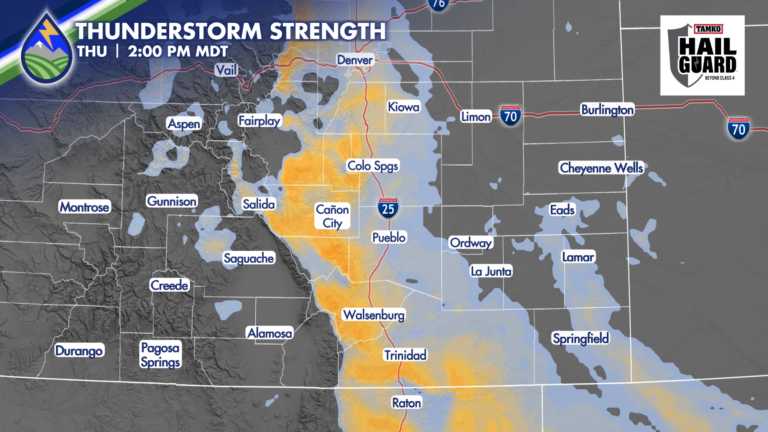
FEWER STORMS, SOME MAY BE STRONG As we get rid of low clouds against the hills today we push low-level moisture against the eastern slopes
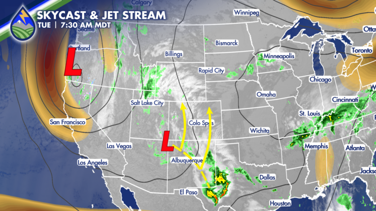
A large area of low pressure over the west coast will steer an upper-level system up from the south over the next couple of days
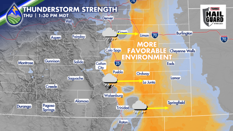
SEVERE STORMS POSSIBLE THURSDAY Warmer afternoon temps, an approaching wave from the northwest, and abundant low-level moisture will combine to support strong to severe thunderstorms
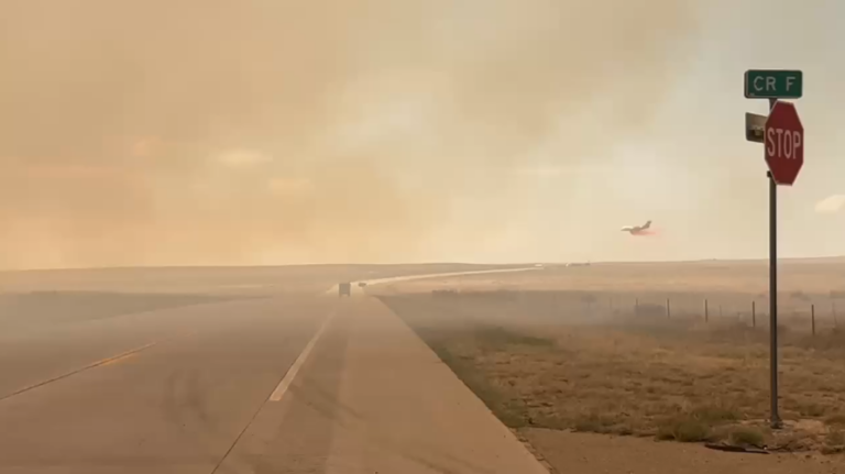
FIRE NEAR CAMPO: An Interview in Town I worked with Jonathan Petramala in the late 2000s and he’s had an incredible career after his time
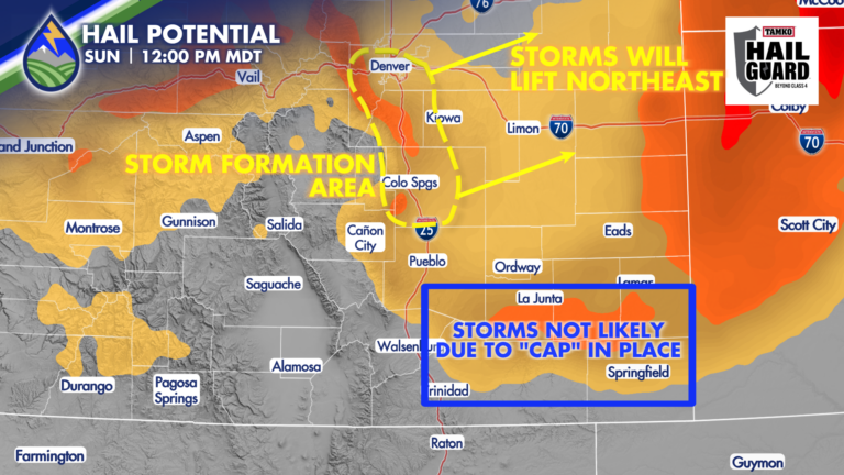
HAIL POSSIBLE WITH SUNDAY’S STORMS Behind the morning cold front, surface moisture is higher than what it was on Saturday – that’s more fuel for
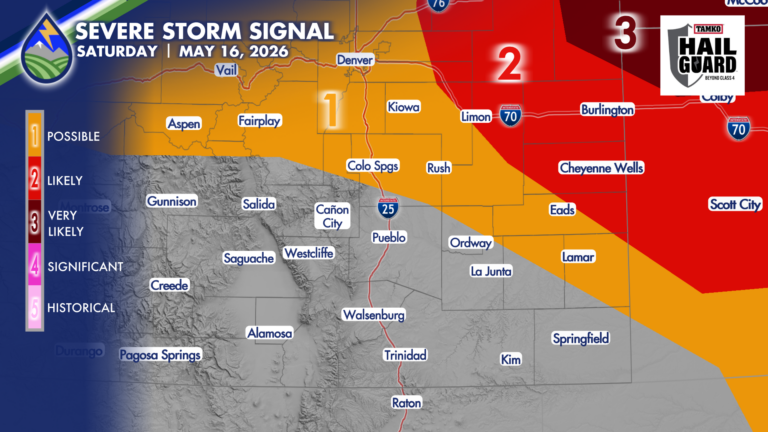
GUSTY THUNDERSTORMS Southwest flow off the mountains dry the lower atmosphere out today. For areas where we can hang on to dewpoint temperatures in the
FRIDAY We start watching the western edge of low-level moisture the next few days as there are some non-zero chances of severe storms over parts