Forecast
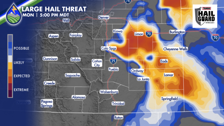
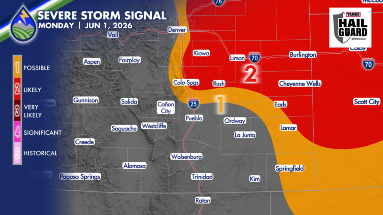
Large Hail on Monday
LARGE HAIL DAY MONDAY Storms may not really take off until the middle to late afternoon on Monday, but when they do, high impacts are








LARGE HAIL DAY MONDAY Storms may not really take off until the middle to late afternoon on Monday, but when they do, high impacts are
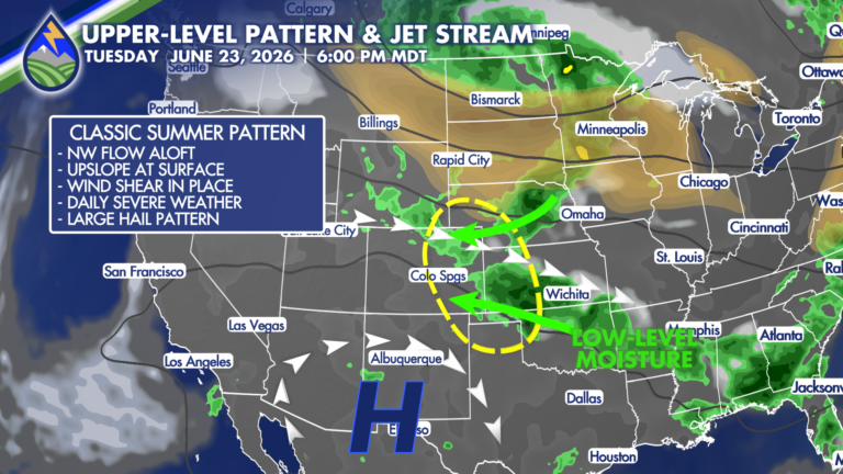
CLASSIC PATTERN EARLY IN THE WEEK Low-level moisture moving up the slope toward the Rocky Mountains and northwest flow aloft riding a ridge to our
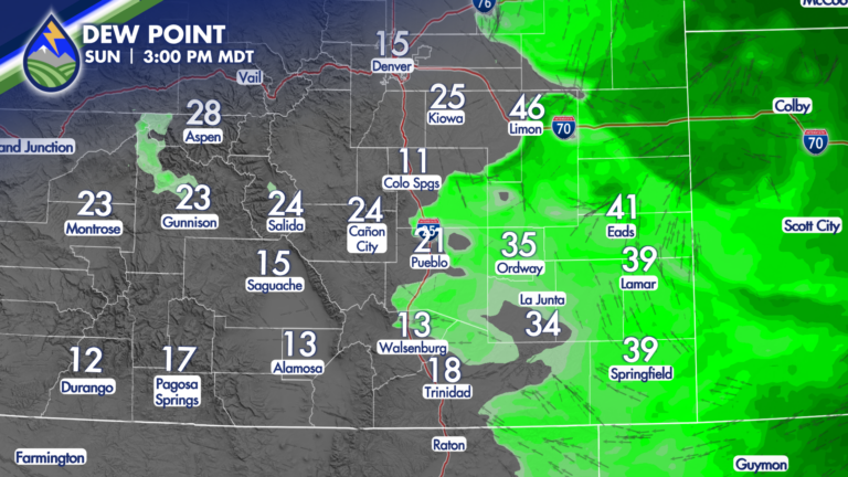
Low-level moisture is lower this afternoon and there is less oomph in the mid-levels of the atmosphere compared to Saturday. It means fewer storms
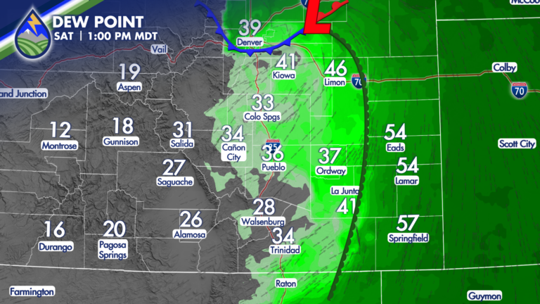
Severe Storms or High Fire Danger Saturday Welcome to your weekend! A system passing over Colorado and Wyoming on Saturday is going to make for
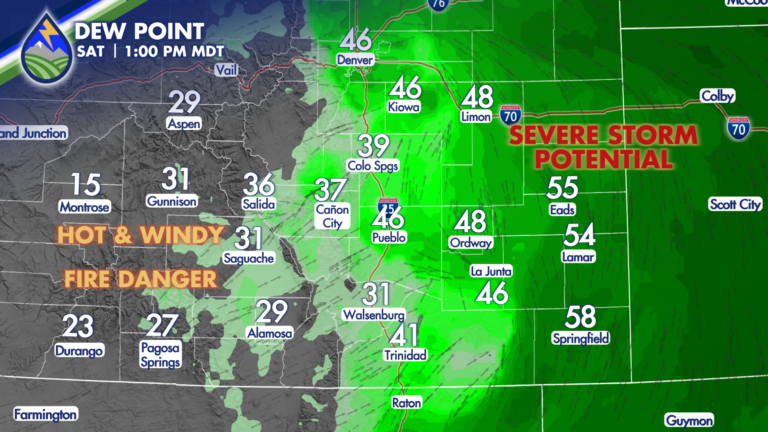
SIGHTS ON SATURDAY Your weekend begins with a very interesting weather day. As a system approaches the region from the west, scheduled to move across

Utah was blowing and Kansas was sucking yesterday and we were the windy spot between! There was sand in the air, there was dust in
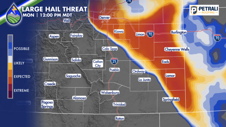
HAIL NEAR 2″ POSSIBLE I’m watching northeast El Paso County and the Palmer Divide today for a supercell thunderstorm or two that may produce very
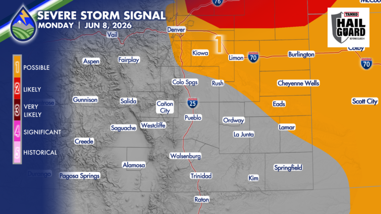
I’ve got some questions as to exactly where the cool front and the low-level moisture behind it end up. It’s important…it’s going to drive where
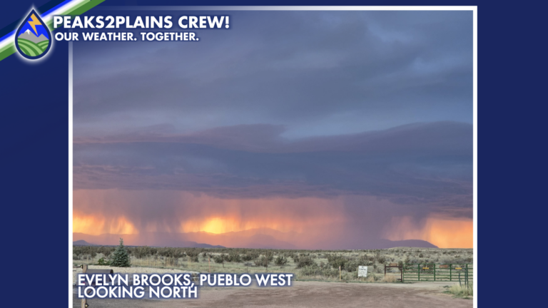
Outflow boundaries moving across southern Colorado on Saturday. One moved into El Paso County from the south in the mid-afternoon and didn’t do much. Another
*UPDATE* SEVERE STORM POTENTIAL As the area of low pressure is spinning up over southern Colorado now, I’ve pulled our chances for severe storms back