Forecast
More of the Monsoon: Next Week
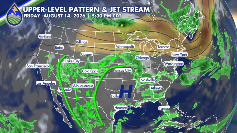
MORE OF THE MONSOON After a break this week, we’re set for another stretch of the monsoon for the middle of the month. We’ve been








MORE OF THE MONSOON After a break this week, we’re set for another stretch of the monsoon for the middle of the month. We’ve been
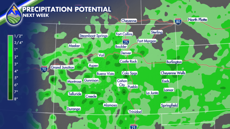
WEEKEND HEAT AND SMOKE Near or record heat will be with us through the weekend with a high off to our east. The other thing
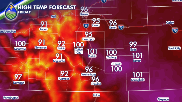
It’s going to be HOT for the next few days. Our area of high pressure is going to situated itself over northern Arizona and the
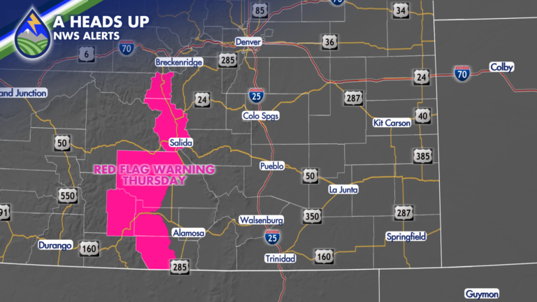
As temps come back up east of the mountains tomorrow…the wind will blow a bit up over the continental divide as the warmer airmass moves

My son and I were tossing discs on the course at Cottonwood Creek Park Tuesday evening and the sunset was way better than my score.
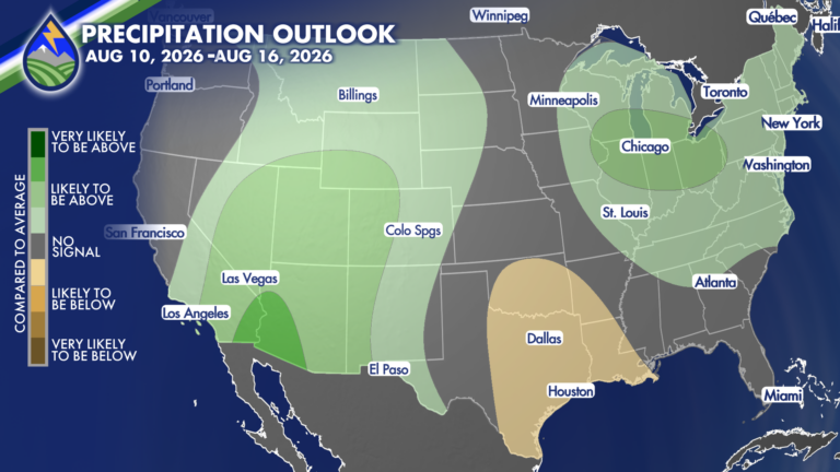
DRIER STRETCH AHEAD We’re heading into a drier stretch ahead of another active monsoon stretch for the middle of the month. Even with a cold
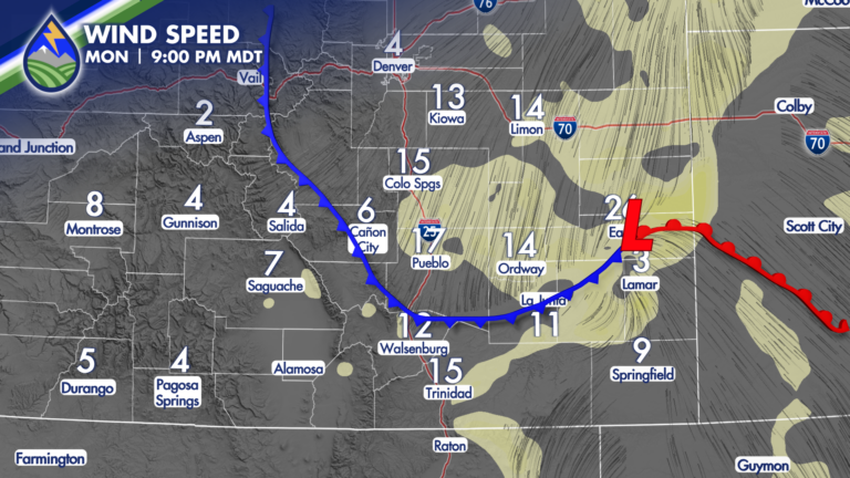
RECORD HEAT FOR A COUPLE OF DAYS A cold front is set to come into the area Monday night and break the heat with an
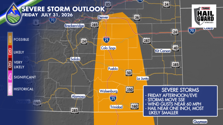
SEVERE STORM OR TWO POSSIBLE Behind this morning’s cold front, we’ll have enough wind shear along with low-level moisture being pushed up against the eastern
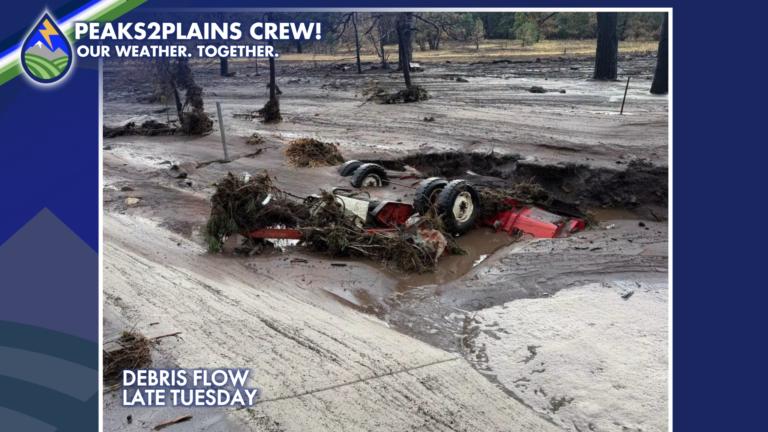
The Aspen Acres burn scar really moved Tuesday afternoon, brining mud and debris down, particularly north of Beulah. These photos from the Pueblo County Sheriff
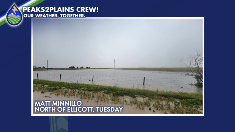
HEAVY RAIN TUESDAY Radar estimates overlaid with reports from CoCoRaHS show a number of areas with between 3/4″ and 2″ on Tuesday. The pattern isn’t